I had the morning off yesterday, and decided to go for a hike. If you’ve been following me, you know I’ve been doing the “52 Hike Challenge” since January of this year. I try really hard to do a new trail each time. As I was searching for a hiking option, I came across the “Lakeside Drive Trail” series of geocaches. I hadn’t seen this set before, and upon a little investigation realized that there was a new trail in the city of Franklin called the Lakeside Drive Trail.
I couldn’t find any information on this trail online, which is a typical problem with lesser-known trails in this region. To address this issue, I’ve decided to write-up some simple guides to hiking some of these trails. This is the first installment in my series of Trail Guides for Western North Carolina.
Basic Information
Location:
This trail is located off of Lakeside Drive in Franklin, North Carolina. The trailhead is in the back of a parking lot across from the Macon County Detention Center (aka jail). I’ve been unable to locate an exact address or coordinates for the trailhead, but it shares a parking lot with the Detention Center, Health Department, and several other small government buildings. Upon entering the parking lot, turn to the left and keep left. You’ll see parallel parking spaces right before a sign that says “Restricted Area”. Don’t worry, you won’t get arrested unless you’re trying to pet the county Bloodhounds that are in a fenced-in area nearby.
Length:
 A trail map located in the mailbox next to the trailhead sign (that simply reads “New Trail”) states that the total trail length is 1.25 miles. After walking it, this seems fairly accurate. There is a 1/2 mile loop section and then a dead-end section that juts off from that. The 1.25 miles is the entire loop + to the dead end and back. I hiked the lower trail first, then completed the upper loop for the total 1.25 miles.
Difficulty
The trail is labeled “moderate”, however I’m under the impression that it was created with the average population of Franklin in mind, which is mostly older individuals. The entire trail is a very wide path that appears to have been an old service road. It is gravel footing most of the way. There are no rocks or roots to trip over.
Elevation
I have not been able to find an elevation profile, but the trail rolls up and down the hills with the landscape.
Detailed Description
Following the lower trail from the parking area, you begin a gradual downhill grade on a wide path. You’ll reach a fork. To take the lower trail, turn sharply right downhill. You’ll pass an old, dilapidated shed on the right. Once past the fork you begin a mostly uphill grade with a few sections, each very short, of fairly steep grade. There are benches every 1/10 mile or so on this stretch if you need to stop and rest. 
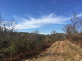
You’ll know you are at the end when you reach the “End of Trail” sign posted beside the last bench. Turn around: there’s a nice view behind you. From here, hike back the way you came to the with the upper trail. Note: as you approach the intersection, you’ll notice a level side trail heading off straight ahead of you that is clear and mossy – this is not the public trail and leads instead to someone’s private residence. Don’t go that way. Instead, keep left at this fork, go steeply uphill past that old shed again, and keep right at the next fork to begin the loop portion of Lakeside Drive Trail.
From here the trail loops around past the environmental resource center and you’ll pass another trailhead. From best I can tell, this trailhead is not accessibly to vehicles due to the road being gated. There may be a back way in that I don’t know about. From here it’s mostly uphill, though not steep, back to the beginning of the loop.
Other Features
There are three geocaches located on this trail. They are all located on the upper trail and are very easy to locate. Reference the geocaching website or your geocaching app for details. I was able to quickly and easily locate all three.
Good for:
- Dogs?
- Yes. My dog enjoyed the romp.
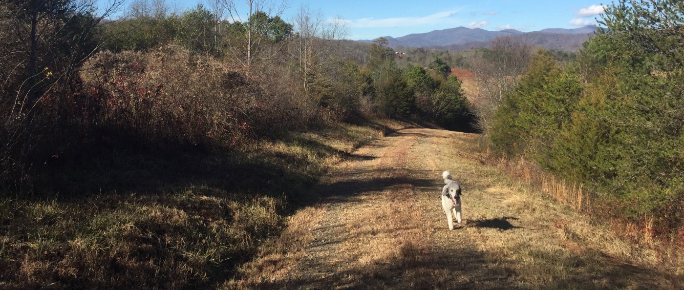
Top of the upper loop trail - There are no posted signs about leashing, nor have I been able to find a specific law in Macon County that requires dogs to be leashed.
- I would assume the law requires all dogs to be under direct control of the owner when not on the owner’s property (this is a standard county ordinance) and therefore would keep your pet under physical control at all times while on this trail.
- Precautions: There are two county-owned bloodhounds housed near the trailhead – absolutely do not allow any interaction between your dog and the bloodhounds. There was a carcass, my best guess is a fox, about halfway down the lower trail – be aware of your surroundings. There is a cow pasture adjacent to the lower trail, as well as a landfill adjacent to the upper trail – I would not allow my dog to drink or play in any standing water or streams along this trail.
- Yes. My dog enjoyed the romp.
- Kids?
- Yes. This trail would be great for any size family as visibility is high, the trail is wide and safe, and dense vegetation and/or fences on either side discourages leaving the trail.
- Elderly or disabled?
- Maybe. The trail is wide and graveled. Someone using a cane or crutches could use this trail. A wheelchair would have a hard time.
- There are areas with fairly significant grade but they are not long. Unless an individual suffers from severe breathing or cardiovascular issues, I’d say pretty much anyone could walk this trail.
- Camping?
- There were no signs related to camping, but due to proximity of government owned work sites, farmland, and private residence, I would not recommend camping along this trail.

Leave a comment