- Hike name: Mill Creek Falls vis Ansted Rail Trail
- Hike length: 2.41mi
- Elevation gain: 197ft
- Hike type: Out-and-back
- Pet friendly (must be leashed!)
- Fees: None
- Land management agency: Hawks Nest State Park / Town of Ansted (varies)
- Land acknowledgement: Shawandasse Tula (Shawanwaki/Shawnee), S’atsoyaha (Yuchi), Yesan (Tutelo), and Moneton ancestral lands
- LAND USE DISCLAIMER: If you visit this location based on the information I have provided in this blog, you agree to follow all posted and established rules pertaining to ethical land use including: leave what you find (harvesting is illegal), pack out all trash and waste including pet waste, keep pets leashed (posted rules), respect wildlife and other visitors, and leave it better than you found it by picking up any trash you see.
- Trailhead coordinates: 38.13461, -81.10100

June 2, 2022: I began planning my summer adventures as soon as I accepted my second travel nursing contract in Charleston, WV. While it isn’t Colorado or Alaska like I really wanted, West Virginia is chock full of outdoor adventures waiting to be had. Not only that, it’s full of waterfalls.
Today was my second full day in Charleston, and I wanted to take time to get grounded before my first day of work tomorrow. I knew the best way for me to do that was to get outside, but I wasn’t quite sure which direction I wanted to head when I awoke.
I’ve been trying to get my hands on a few West Virginia hiking books, and having no luck online I hit a few locally owned bookstores over the last few days. Still no luck, this morning I decided to try Books-a-Million; as much as I hate going to chain bookstores, I lucked out here. I nabbed three WV books and one Red River Gorge book that was steeply marked down for later use. While there is LOADS of free information available online, I find print hiking books like these to be immensely useful: they are usually more reliable, more accurate, and have information in them you can’t find easily in other places. Using these books as a guide, I decided to head out to see several waterfalls in the vicinity of Ansted, WV and Hawks Nest State Park.
In case you are interested, the two books I picked up were Hiking Waterfalls in West Virginia, by John Malloy, and Waterfalls of Virgina and West Virginia, by Randall Sanger.

The first waterfall I wanted to see was Cathedral Falls, which I’d pinned in Gaia several weeks ago and which came highly recommended by a local I met at a bar last night. I pulled up Gaia, selected the pin, and clicked “driving directions” which I have set to automatically open in Google Maps. I put on a podcast, hit “start” and didn’t bother to look at the map again… until Google tried to turn me onto a double-track trail it thought was a road. By now I didn’t have signal so I pulled up Gaia and realized I was far, far away from Cathedral Falls. I have no idea why Google does this sometimes, but it isn’t the first time it’s happened to me and I should know better than to mindlessly follow it. Thankfully, I tend to have the forethought to download Gaia maps for offline use prior to visiting any area, and I was able to use Gaia to navigate back out of there. I was today years old, however, when I realized I can pull up the Gaia app directly on my 4Runner’s dashboard and use it for on-screen navigation. I decided my next stop would be a series of waterfalls on Laurel Creek, so I pulled up the pin on Gaia began route finding.
I found information about a series of waterfalls on Laurel Creek in both of the books mentioned above. Laurel Creek Falls (Cotton Hill) and at least two other waterfalls upstream of it don’t have a great place to park for a good view. Accessing the creek requires parking off a busy highway, walking down the highway to a certain spot, then dropping down the bank to the creek. As I began to walk down the highway, leaving Shooter in the car for safety reasons, the bottom dropped out of the sky and I began to worry about visibility and safety– I know how people forget how to drive in the rain.
I decided to call it quits on the Laurel Creek waterfalls and save them for another day due to my safety concerns, so I high-tailed it back to my vehicle. Again using Gaia since I didn’t have signal, I headed to the next spot I had wanted to check out today: Mill Creek Falls.
This waterfall is an excellent example of why I like to use multiple sources of information when choosing an access point and a route to waterfalls. One of the books I purchased today said to park off the side of a gravel road and scramble down the bank to the waterfall, and called it the “best” route. Well, unpopular opinion: the shortest route to a waterfall is not always the best.
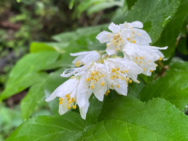
After two failed waterfall attempts already, I wanted to get out and stretch my legs some. I cross-referenced the second waterfall book I bought and discovered that this author described a longer route via a converted “rail trail” that starts in the small town of Ansted. This trail walks an old railroad bed beside the creek, through wildflower thickets and rhododendron. It sounded like a pleasant walk, so I opted for this route over the short bank scramble.
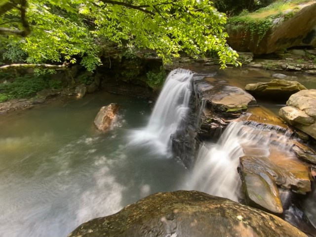
By the time I drove from Laurel Creek, which is off Highway 16, around to the small town of Ansted, the skies had partially cleared and some blue sky and sunshine peaked through the clouds. I easily found the trailhead, parked, and started walking. This trailhead does have bear-safe trash cans and a bathroom house, however at the time I visited the restrooms were marked “closed” and were locked. Shooter and I started down the trail in the direction of the waterfalls we came to visit and quickly came to an old railroad trestle which has been converted into a footbridge across the expansive Mill Creek. From this trestle, Westlake Creek Falls can be seen tumbling into Mill Creek, and Upper Mill Creek Falls can be seen as well. There is no good access to the creek from this point, and I did not scramble down below the trestle to do so.
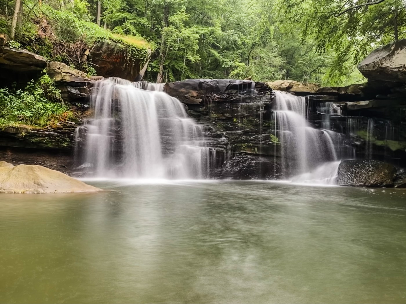
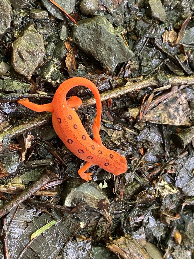
Once we were past the footbridge, we traversed a very gently graded (4%), wide trail all the way to the main attraction: Mill Creek Falls. I haven’t hiked very many rail trails; in fact this may only be the second one I’ve been on– the first was the Virginia Creeper Trail in Damascus, VA. One thing that I love about these trails is that they are generally wide and mostly flat, which makes for easy walking which doesn’t require constantly looking at your feet. However, if you are hiking this trail in late spring/early summer I recommend occasionally looking down! I almost missed a cute Red Eft!
Once we arrived at the falls, which had a nice viewing area from a flat rock outcropping directly above the falls, I realized that there was, again, no good access to the creek from this trail. The creek was not particularly high, so I plotted a rock hop across to the other side. This brought me to the area along the gravel road which was mentioned in the first book– where the author recommended parking and scrambling down the bank. I walked a few feet downstream on the road and found a good place to scramble down. As Shooter and I reached the creek bed I heard the low rumble of thunder followed by a louder CRACK! I didn’t see any lightening, but decided to snap my photos quickly and get outta there.

By the time we climbed back out of the creek bed, a full on deluge was rapidly soaking us through and through. I brought a raincoat, but the weather was warm and I really enjoy the sensation of raindrops hitting my skin, so I opted to not use it. Shooter and I walked back to the car the same way we’d come, crossing the creek above the waterfall to get back to the Rail Trail, and taking it all the way back to my 4Runner. We didn’t see a single other soul on the trail the entire time we hiked.
Back at the car, the rain eased off and I decided to head back toward Charleston. I’d pass Cathedral Falls on the way, the waterfall I’d begun the day looking for. It’s a roadside waterfall easily accessed from a small parking area off Highway 60. The waterfall is stunning, but the setting (right by a busy road) leaves a little to be desired. This waterfall is pictured above next to the paragraph where I discuss google maps taking me to the wrong location.
In all this was a great afternoon spend exploring my new “home” territory, and even with the re-routing, I felt it was productive due to getting to get a sense of the layout of roads and towns for future reference. I anticipate spending a LOT of time out this way in the future. Click the image below to be taken to my Gaia track for this hike.

Nearby waterfalls: Fox Branch Falls, Upper and Lower Turkey Creek Cascades
Nearby attractions: Hawks Nest State Park (no entry fee), The Mystery Hole, New River Gorge National Park

Leave a comment