6.25.22 In early 2020, Eleni and I didn’t know each other (in person; technically we’d been following each other on instagram for years). Independently, we both moved to Asheville, NC for jobs in the same hospital system. At some point between a deadly pandemic and the loneliness of being solo in a new city, we met at an outdoor-seating restaurant and that was kind of it: we were friends. Fast forward two years, we’ve both left that hospital system and taken up the frenzied lifestyle of travel healthcare workers, but not before we moved into a tiny home in the mountains of North Carolina together. We’d been roommates for about a month before we both went our separate ways: me to West Virginia, and Eleni to eastern North Carolina.
Eleni decided to visit me for a few days and I wanted to show her some of the ruggedness of the West Virginia landscapes that I’ve been slowly falling in love with. Eleni and I have the type of friendship where for some reason she trusts me to plan adventures with little input from her, and despite the fact that they almost ALWAYS turn into misadventures, she still somehow believes that I know what I’m doing and gets in the car with me anyway.
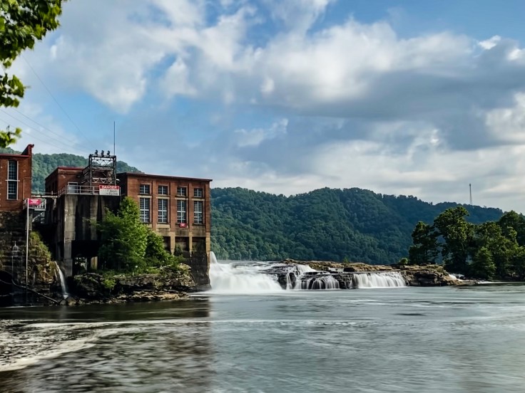
Such was the fate of our adventure today, though neither of us knew it yet when we left Charleston this morning. Driving east from Charleston on Hwy 60 on my days off has become one of my favorite things to do. The drive itself is calm, easy, and beautiful.
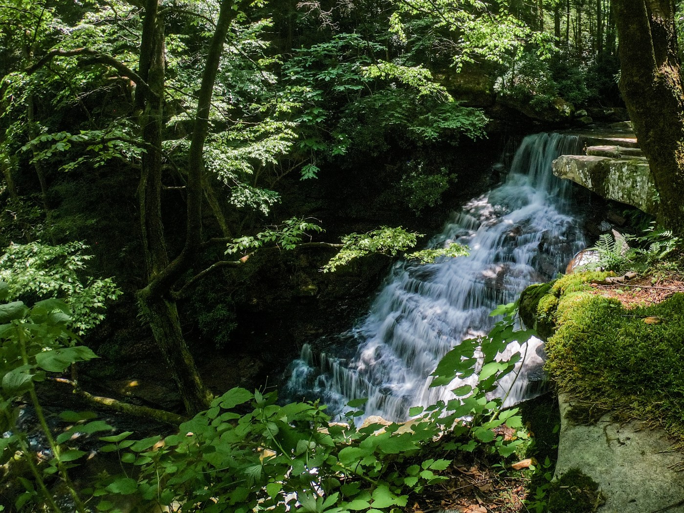
We stop at roadside Cathedral Falls and Kanawah Falls on our way to New River Gorge; I’d seen both of these before, but Eleni had not. Afterward, we pop into Cantrell Rafting to snag a campsite, then head toward the Gauley River National Recreation Area (you’ll remember this wild place from West Virginia Waterfalls: Gauley River National Recreation Area, Part 1). This is the part where Eleni placing supreme trust in me really becomes important. As we drive deeper and deeper into rural West Virginia, twisting and turning past ominous “No Trespassing” signs and bumping along down dirt roads, she never once questions my motives or sanity.
Eventually, we come to a stop at what appears to be a dead end. Straight ahead, at the beginning of the road that all of my sources say we are to take, is a giant “Private Property” sign, with a video-camera icon, and below that “video surveillance in use.” Hmmm. I check the publication dates of the guidebooks I’m using. They are from 2018, which should be recent enough to be fairly accurate. I refer to Gaia, on which I have downloaded a public land overlay that shows the boundaries of public and private property. We are sitting on the boundary line, and if it’s accurate, the road straight ahead should be on public land.

The road leads to the trailhead for Ramsey Branch Falls (and a few other waterfalls which are even more obscure and less known). It apparently also leads to a commercial take-out for ACE Adventure Resort, which if I had known at the time would have probably swayed my decision in favor of driving down it. I did not know this, however, so erring on the side of caution and not getting used for target practice, Eleni and I decide to forego this waterfall and not proceed any further.

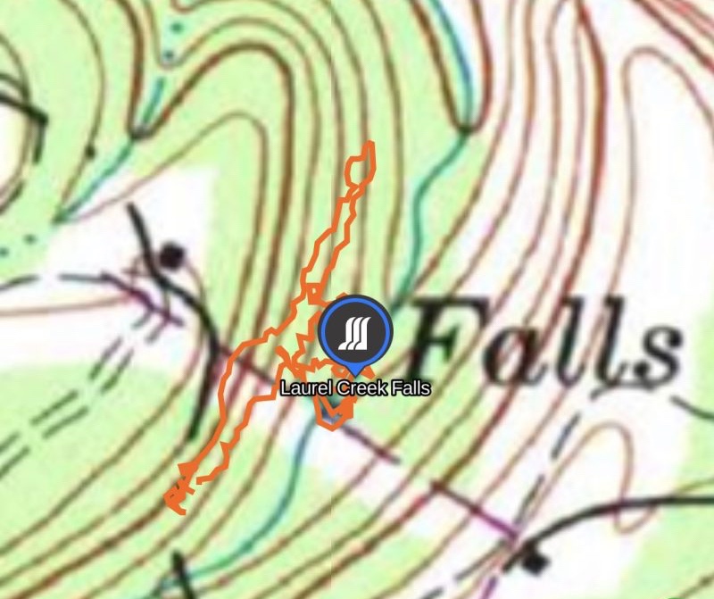
We backtrack and set our sights for another waterfall on this side of the Gauley: Laurel Creek Falls. We find ourselves eventually on a fairly well-maintained dirt road and, following the directions in the guidebook once again, we end up nowhere near the waterfall. Eleni, who’s been riding in the car with me for hours at this point having seen absolutely zero of these remote waterfalls I promised her, patiently points out that maybe the guidebook is wrong (gasp!) We make a 72 point turn (I’m exaggerating) in the middle of the dirt road, Eleni nearly having a heart attack when I get a little too close to the edge (which drops steeply off the side of the mountain we are on), and slowly drive back the direction we came from. I’m following Gaia now, and looking for a spur road off to the left in the direction of the waterfall whose location I have pinned on the map. The guidebook doesn’t mention a spur road; it doesn’t mention turning off of this main dirt road at ALL, and it DEFINITELY doesn’t mention that once you do turn off of the main dirt road onto the spur road that we eventually find, you’ll likely tear parts off the bottom of your vehicle or pop a tire, or both, before you make it back out. Knowing none of this, when Eleni excitedly spots a narrow double-track road veering sharply off to the left, we take it.

Approximately 0.3 miles down this gnarly, rocky, rutted, washed out “road” I said no more. Wonda is mighty capable but I was not trying to rip a tire open today. The trailhead was less than a tenth of a mile further on. We could walk from here. I park as far to one side of the rocky double-track as possible, fully knowing that no one else in their right mind would bring a full-sized vehicle down this road before we got back, and we hop out and hike down.
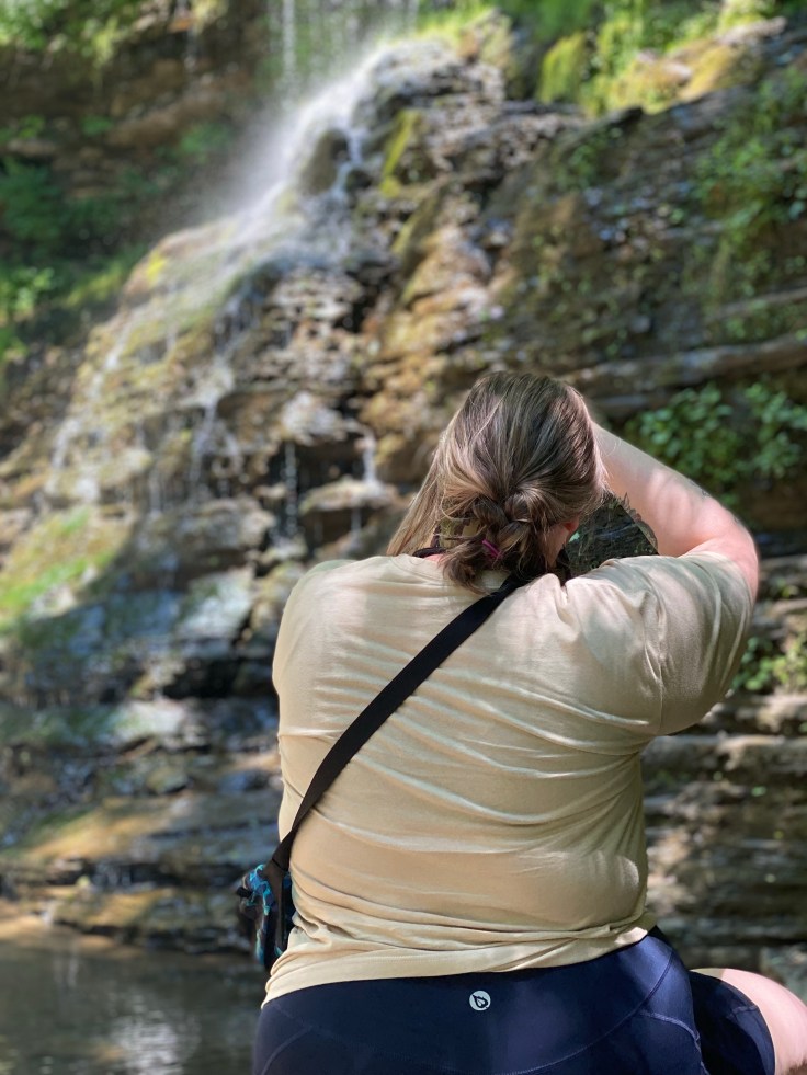
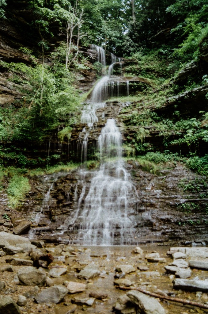
As we descend toward the creek, we notice landmarks mentioned in the guidebook: some sheer cliffs on the left, the remnants of an old out-building on the right. Surely the author didn’t just “forget” that he almost destroyed his vehicle driving to this point right? Anyway, we find the trailhead and follow an unmarked but well-trodden path to a spectacular view of Laurel Creek Falls. Another thing the guidebook failed to mention was exactly how impressive this waterfall is. We were both in awe of it, and spent some time taking photos here.
I had hoped to find a way to the base of this waterfall, but after walking further down the road looking for reasonable route I find no safe spot to descend the steep, muddy bank to the creek (even though the guidebook says there is a way). Eleni and I decide the view from the top is fine enough, and we hike back up to the car. After all, we still have the excitement of trying to get Wonda turned around on this narrow “road” to look forward to.
Another multi-point turn, a switch into 4-low, and a mildly anxious Eleni standing outside the vehicle guiding me by voice eventually gets us turned around and headed back in the correct direction. Eleni hops back into the car and we bump and rock and grind the quarter mile back uphill to the main road. As we eagerly approach smooth brown dirt Eleni blurts out, “well, that would have been nice to know.” She’d spotted a bent metal sign, down in the ditch at the entrance to this road, invisible on our initial approach, on which was stamped in bold capital letters “CLOSED TO MOTOR VEHICLES.”
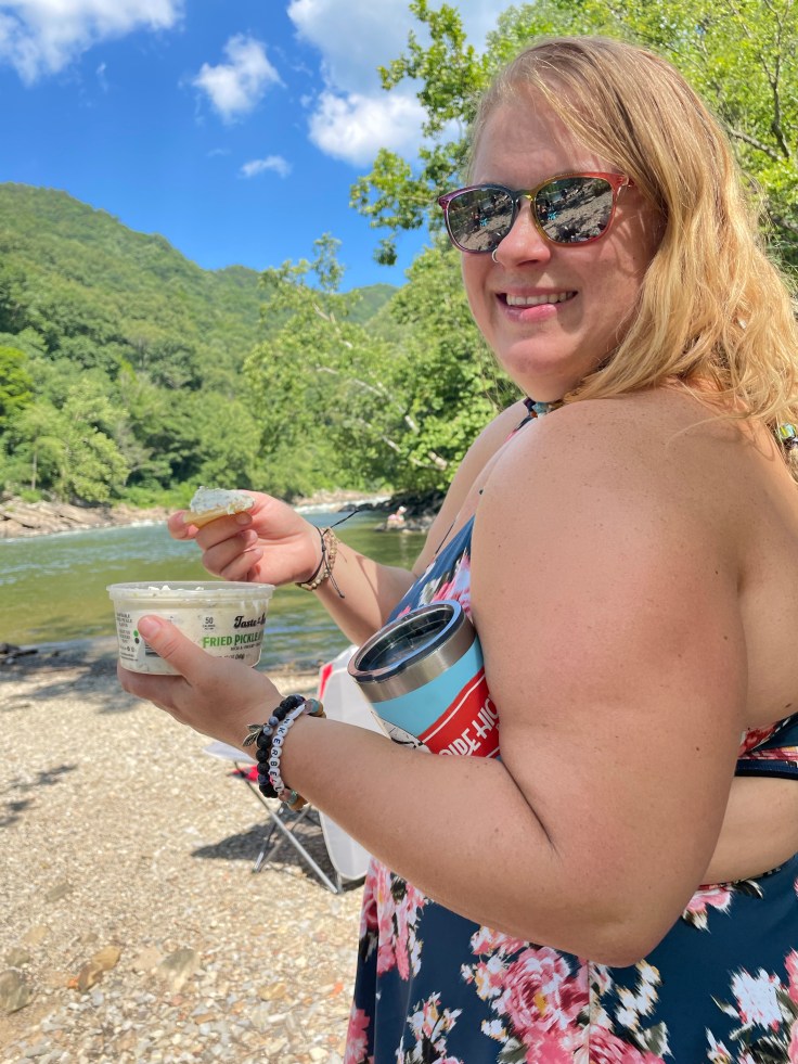
With the worst of the harrowing drive over, Eleni and I are proud of ourselves for surviving unscathed and getting ourselves and Wonda out of the woods in one piece. By this point, we’ve had enough of wrong turns and rough roads, so we leave the backwoods and head for the river, intent to spend the rest of the afternoon sunbathing, eating dill pickle dip, and watching rafters come down the New.