
I am already awake when my alarm goes off at 0630. I haven’t slept well, having a stomach-ache part of the night and anxiety about today’s hike the rest of it. Beth and I are attempting a hike today that is somewhere in the realm of 11-13 miles (we have conflicting reports). I haven’t done a hike this long since April, and honestly haven’t done much over 5-6 miles at all this summer. I’m worried I’m not in good enough shape to attempt it, but we are giving it a go.
This will be a shuttle hike, and our friend Allison has graciously offered to awake at this early hour and drive us to our starting position. Beth left her car at the end trailhead last night, so we are set up for an early start. We’ve been warned about yellow jackets along the trail, and I’m also nervous about that. Allison had a scary encounter with multiple stings a few days ago, and she won’t be joining us today because of the threat of more. I don’t want to get stung, either.
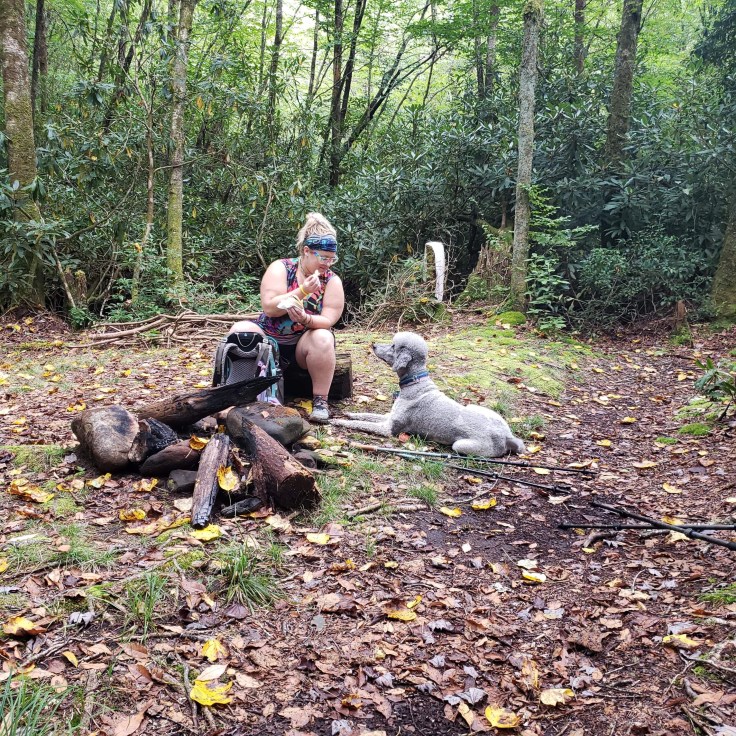
Beth and I make our own breakfast and I feed Shooter a high-calorie meal, packing more food and calories for both of us into my daypack. I’m leaving both of my cameras at home today; I don’t want the extra pack weight with as many miles as we are doing. In the car on the way to the trailhead, I feel a bit queasy, the trepidation sitting like a large stone in the pit of my stomach. I’m nervous, but trying to be optimistic.
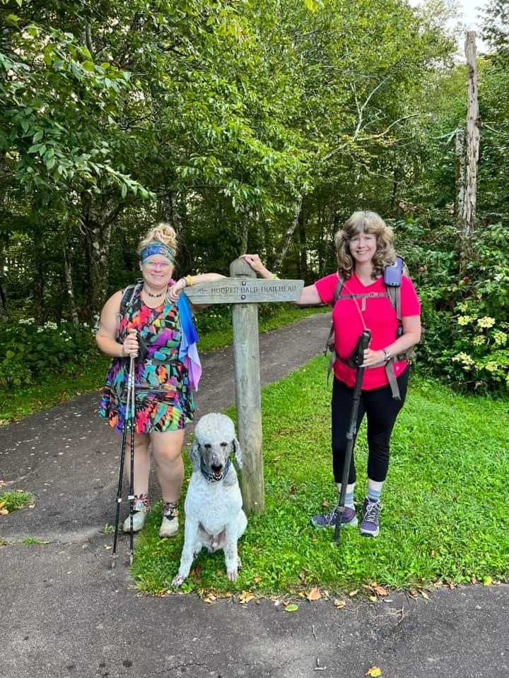
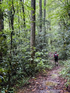
The hike begins at a kiosk at Hooper Bald Overlook, and we follow the gravel trail into the woods. We quickly reach an intersection with Kings Meadow Trail– except there is no noticeable trail where Kings Meadow is supposed to be. I’ve read other accounts of this hike that say to take this trail, however on this day, the trail is either so underused or so overgrown (or both) that it doesn’t exist. Either way, we weren’t planning to take it anyway. Instead, we continue straight as the trail we are on becomes more overgrown. The greenery overhanging the trail is covered in early-morning dew, and as we walk through it we get soaked. It’s chilly this morning, which I’m thankful for. We are expecting decent temps today and I’m so thankful it isn’t going to be hot.
Fairy quickly we reach a gate across a gravel forest service road — McGuires Cabin Rd 2807. This is our route down, and it descends steeply into the wilderness area past some privately owned cabins. The road eventually intersects with what’s labeled a “Hiker Trail” by signage, but is really just a washed out road bed. This is Mitchell Lick Trail, and will be our route until we start the bushwhack portion of our hike. We head right at this intersection, or west if you prefer cardinal directions. Beyond this point, Beth and I are both keeping an eye on our Gaia maps for the location at which we will leave the sanctity of the “trail” we are on and descend off-trail into the wilderness. We get there way too quickly, IMO, and the worst part of this hike begins: the nearly 1-mile bushwhack along a tributary of Snowbird Creek to access three remote waterfalls: Blue Boar, Hooper, and Mitchell Lick Falls.
The bushwhack starts off fairly straightforward through some open hardwoods. We dodge briars as we descend into a gulley and begin to contend with thicker tangles of rhododendron. We are trying to follow a track provided to us by a friend who previously did this hike, but fairly quickly Beth and I agree that following the ridge just above us is a better option than making our way down the dense gulley. We climb back uphill and are immediately rewarded with much more open forest and easier going. As we follow the ridge, which eventually dips down toward the tributary and intersects with our friends’ route, we hear dogs barking and baying in the distance. Bear hunting season has just started, and we both suspect a pack of hunting dogs is roaming the valleys below.
We make good time moving down the ridge, but once we reach the creek it’s an entirely different story. The rhododendron and mountain laurel create a dense tangle that is next to impossible to navigate through. Deadfall everywhere means lots of climbing over and under and over again. The soft, boggy, moss-covered soil isn’t truly solid ground, and we often sink to our calves or even knees when it gives way to open air below. I’ve read other accounts of simply walking the creek, however there is so much deadfall in the creek that walking down it is impossible in places. There’s lots of going down to the creek, bushwhacking back up, back down, back up. The going is excruciatingly slow and painstakingly difficult.

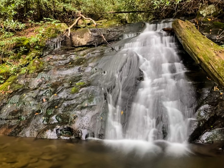
We reach Blue Boar Falls first, the upper-most of the three waterfalls on this tributary. It’s pretty, though I wonder if it was worth the effort at all. Thankfully, we can see the rim of the second waterfall, Hooper Falls, from the base of Blue Boar and know it’s only a short bushwhack around to the base of it. Two waterfalls in rapid succession is a nice reward for all of our hard work.
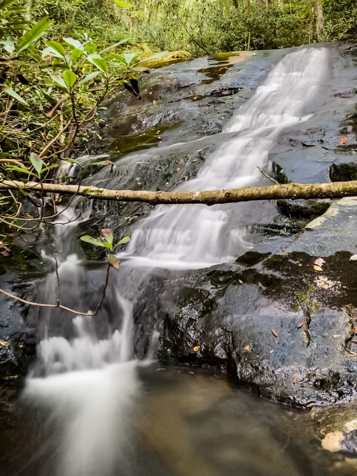
Reaching Mitchell Lick turns out to be a much more difficult endeavor, as the bushwhack gets thicker and more difficult the further down the creek we progress. We are attempting to follow what appears to be a very old logging grade on river-right, but its so overgrown that it’s barely discernible as such and often disappears or becomes so densely tangled that we have to leave it. I’m cussing and grunting and “OWW!”-ing my way through, with Beth just ahead of me doing the same. We do eventually reach Mitchell Lick Falls, which we both agree is the best waterfall on this trib, and we stop here for a snack.
Too soon it’s time to continue the bushwhack. Now, we have our sights set on reaching Big Snowbird Trail (TR64). The tributary we’ve been following meets Snowbird Creek further down, and just beyond the confluence is where we will pick up Big Snowbird and follow it for the next several miles. I’m so ready to be done with this bushwhack; bushwhacking isn’t my favorite thing to do anyway but THIS kind of bushwhacking is by far the worst. We finally reach a point where Beth suggests heading down to the creek and I reply, “Beth, if I go down to the creek again, I’m staying in the creek.” I’m ready to face the consequences of such a decision, whatever they may be; walking the creek has to be better than what we are doing. I haven’t stood upright since we left Mitchell Lick, and I’m positively miserable.
Walking the creek out from here, much like our choice to regain the ridge and follow it earlier, turns out to be the right decision. The creek is shallow enough to walk down, and the vegetation is much less dense. I’m able to stand upright, and we only have to bushwhack around a few areas of deadfall or steep drops. When we finally reach Snowbird Creek, I think Beth and I are both eternally grateful to be done with the hardest part of our hike. The bushwhack takes us over two hours, and we’ve still got over 10 miles to go.

Before too long we begin to hear dogs barking and baying again. We hadn’t heard them since we were up on the ridge at the very beginning of the bushwhack, however now the noise gets closer the further we walk. I count 5, maybe 6 distinct canine voices and it sounds as though they are staying in one spot. Beth mentions that it sounds like they have something treed, and we both agree that it could likely be a bear, since it is bear hunting season in North Carolina. We eventually get very close to the dogs, but never can see them through the trees. I have to say, knowing that a pack of hunting dogs is loose nearby is a bit unnerving, and knowing they probably have a bear in a tree not far from where you are standing doesn’t exactly help settle those nerves.
Thankfully, the vast majority of this hike is a nice, gradual downhill grade. Now that we are on an actual trail (though, this “trail” is rather rough and unmaintained), we move a lot more quickly. We will stay on Big Snowbird Trail for the next several miles, and our next destination is Upper Falls.
Upper Falls isn’t really anything to write home about. It’s a nice cascade, but difficult to see all of at once. I’m satisfied with the view from the trail, but Beth decides to wade into the creek for a better look. She says it isn’t worth it, and I believe her. Besides, I’m too anxious about the next part of our hike; our friends told us there was an active yellow jacket nest between Big and Middle Falls. I’m going to take the lead during this stretch, since Beth thinks I’ll have a better chance at spotting the nest. We set a fairly quick pace, hoping that if we do pass the nest without seeing it we will be moving quickly enough to get by without anyone getting stung. It’s a little over a mile between Big and Middle Falls, and as we get closer my heart rate gets faster. I can feel the panic trying to rise in my chest.

I’m not afraid of or allergic to yellow jackets, but they can be very aggressive. If they swarm, there is a significant risk of multiple stings causing a systemic reaction similar to anaphylaxis– this is what happened to our friend Allison two days prior– and we are a long way from civilization out here. I’m sure I’m visibly shaking as we finally reach the intersection with Middle Falls Trail, where we will temporarily leave Big Snowbird to hike down to Middle Falls. We must have passed the nest without noticing, and we both hope any risk of swarming flying assholes is behind us.
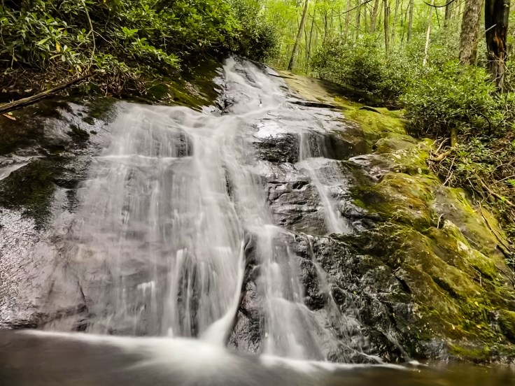
Middle Falls is 100% the highlight of this hike and the one waterfall that I think is really worth visiting. It spans the width of Snowbird Creek, tumbling over a broad ledge in multiple spills into a serene pool bordered by mossy rocks. The whole setting is serene and beautiful, and I take a moment to sit in the sunshine and recover from my anxiety-and-panic fueled race to get here. I try to snap a few photos in live mode on my iPhone to turn into long-exposure shots late, but my hands are shaking so much from the adrenaline that I’m sure they won’t turn out. Beth is taking a picture for me as the rain begins. It will stay with us for the rest of the hike.

Beth and I briefly debate taking Big Snowbird Trail– the “lower” route– or Middle Falls Trail– the “upper” route– from this point. Both options are equidistant, but the lower route crosses Snowbird Creek several times and the creek is rather high. The upper route bypasses the creek crossings, but involves some elevation gain. I’m already exhausted. We still have about 5 miles to go. I vote for the lower route, but Beth wins out with logic: the creek could be dangerous at its current level. We climb up Middle Falls Trail and follow it around until it intersects once again with Big Snowbird Trail.

Up to this point, we have passed several abandoned pieces of gear: a couple of old campsite with tarps, buckets, and paint cans strewn about, and sleeping bag in a stuff sack tossed on the side of the trail, and now as we re-join Big Snowbird trail we encounter a large campsite with trash strewn all over the place. Normally Beth and I would pick up trash along the trail, but this is way more than we are prepared to deal with and we have no choice but to leave it.
We have one final waterfall: Big Falls. By the time we reach it, Snowbird Creek is far below us and we are hiking along either an old roadbed or railroad bed, I can’t be sure which. Big Falls is another long, cascading, creek-wide waterfall. We see the beginning of it from far above on the trail before reaching the scramble path to the base. We are 3.5 miles from the car at this point, and I’m totally wiped out. I have absolutely no energy left to make the long scramble down and back up, and I decide that I’m perfectly fine with the limited view I have through the trees. Beth has already been to this waterfall, so she agrees to continue on.
This has to be the longest 3.5 miles I have EVER hiked. My feet are screaming. My legs are so tired they are protesting forward movement. A scratch on my inner thigh from the bushwhack has chafed into a bleeding wound. It’s still raining. I can’t wait to be done. Hours seem to pass before we finally reach the end and Beth’s car. I’m so thankful to sit down, but not sure I’ll be able to stand up again once we are home. We hiked 12.5 miles and 9.5 hours, seeing six waterfalls along the way. I’m beat, but proud of myself for doing it, and thankful it’s over and I never have to do it again.

Footnote: there is a 7th waterfall that can be accessed as part of this hike but taking a spur trail down Sassafrass Creek to Sassafrass Falls. This would add an extra 1-2 miles to the hike. I opted to return for this waterfall at a later date due to the difficulty of the hike and my exhaustion level.

Leave a comment