
Following our Gauley trip, Jen heads home and I head back to Charleston, reluctantly. I want to continue camping, but Hurricane Ian has put a damper on those plans. The next two days are supposed to be extremely wet, cold, and windy; aka not ideal hiking or camping weather. I end up spending two days in Charleston before my itchy feet get the best of me and I head east. I’ve been wanting to revisit the Seneca Rocks area, and there are some waterfalls along the route that I’ve been dying to see ever since I learned of them on a previous trip to Blackwater Falls. With Shooter in tow and the cooler packed, I head out on what is sure to be a colorful autumn adventure.
Waterfalls of North Fork Blackwater River
Today’s destination is a series of waterfalls near Davis, West Virginia: a quaint mountain town near Blackwater Falls. My research has lead me to the waterfalls of the North Fork Blackwater River, just outside Blackwater Falls State Park along a trail called the Blackwater Canyon Trail, which is an extension of Rail Falls Rd. From what I’ve read, there are multiple dispersed campsites along a 4×4 road called Backbone Mountain Rd near the falls, and my plan for the night is to set up camp along this road, then hike to the various waterfalls in the area before heading back into Davis for dinner and a beer, and finally heading back to camp. The drive out to this particular area is a little disconcerting– if I hadn’t known for absolute certain based on prior research that I was headed the right direction, I probably would have assumed I was lost and there was no way a public trail existed down here. Ramshackle and run down houses, shacks, and mobile homes litter the roadside and “No Trespassing” signs abound. I’m sure I’m headed the right way, though, so I keep going and do eventually reach the National Forest boundary and public use area.

I want to find a campsite first, since I had a 3 hour drive to get here and I don’t want to run out of daylight. I continue past the turn onto Rail Falls Rd and follow Backbone Mountain Rd past several vacation rentals until it turns to dirt. Less than half a mile in, however, I abort mission. The road is in HORRIBLE shape; it’s rutted, washed out, and water is actively flowing across and even down the middle of the road in multiple locations. I’m quite sure Wonda is capable of driving this road, and also quite sure that I have no intentions of testing her limits while out here by myself. I decide to hike and re-evaluate my camping options later, even if it means I have to get a hotel room for the night. I’d rather do that than risk ending up stuck or stranded in the middle of nowhere.

After a thirteen-point turn I’m headed back the direction I came from. I turn right onto Rail Falls Rd, passing Albert Falls, a roadside waterfall, on the way to the trailhead, in addition to some old coke ovens that are crumbling from the passing of time. I reach the trailhead to find one car there, but the owners arrive before I leave for the hike; it looks like I’ll have the trail to myself. There are three waterfalls in close proximity to each other that can be accessed here, and a longer hike can take you to a few more. I’m running out of daylight and only intend to visit the first three today: Teresa, Douglas, and Kennedy Falls. The first two are trailside, but Kennedy requires what I’ve read is a steep and slippery bushwhack. I have the location marked and am confident I can find it. I leave my car and continue along the old railroad grade that is Rail Falls Rd, but turns into Blackwater Canyon Trail at the trailhead.


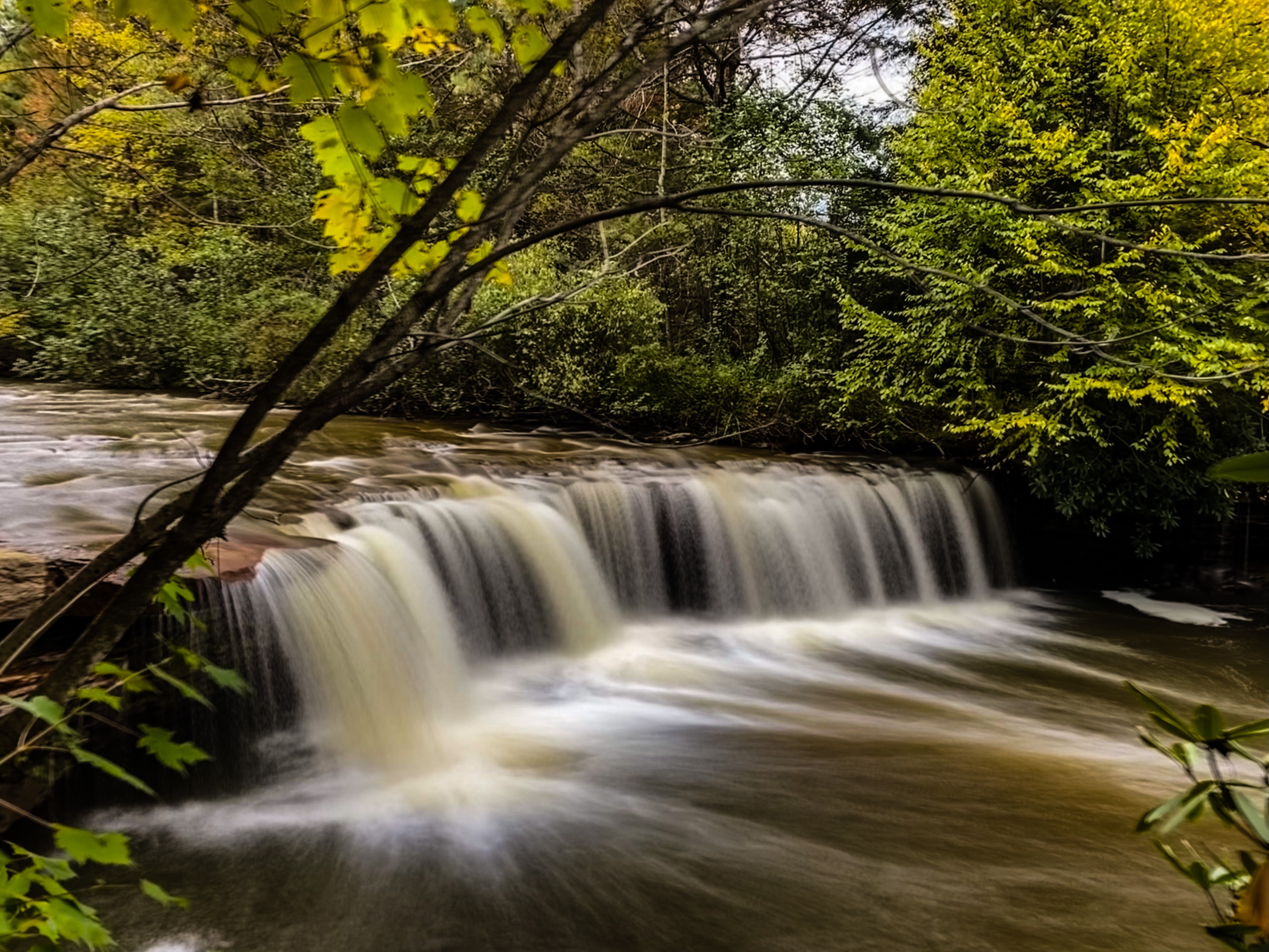
Blackwater Canyon Trail is wide, flat, and smooth. We quickly arrive at Teresa Falls, which is more of a long slide than an actual waterfall, but is pretty nonetheless. The rock here is a vivid red-orange, stained from centuries of the tannin-rich water of the Blackwater River flowing over it. The red hue of the rock makes the water appear to be a soft turquoise in certain conditions, though today the river is raging, swollen from the hurricane rains that drenched the east coast over the weekend.

Once we reach a gate, I can hear Douglas Falls roaring below. A short scramble to the base reveals an absolutely awe-inspiring drop. As soon as I laid eyes on it, Douglas Falls jumped into my top five West Virginia waterfalls. I spend some time snapping photos from different angles, wishing the water level was a little more forgiving so I could reach a better vantage point, but also standing in awe of the sheer power of the water rushing past me.

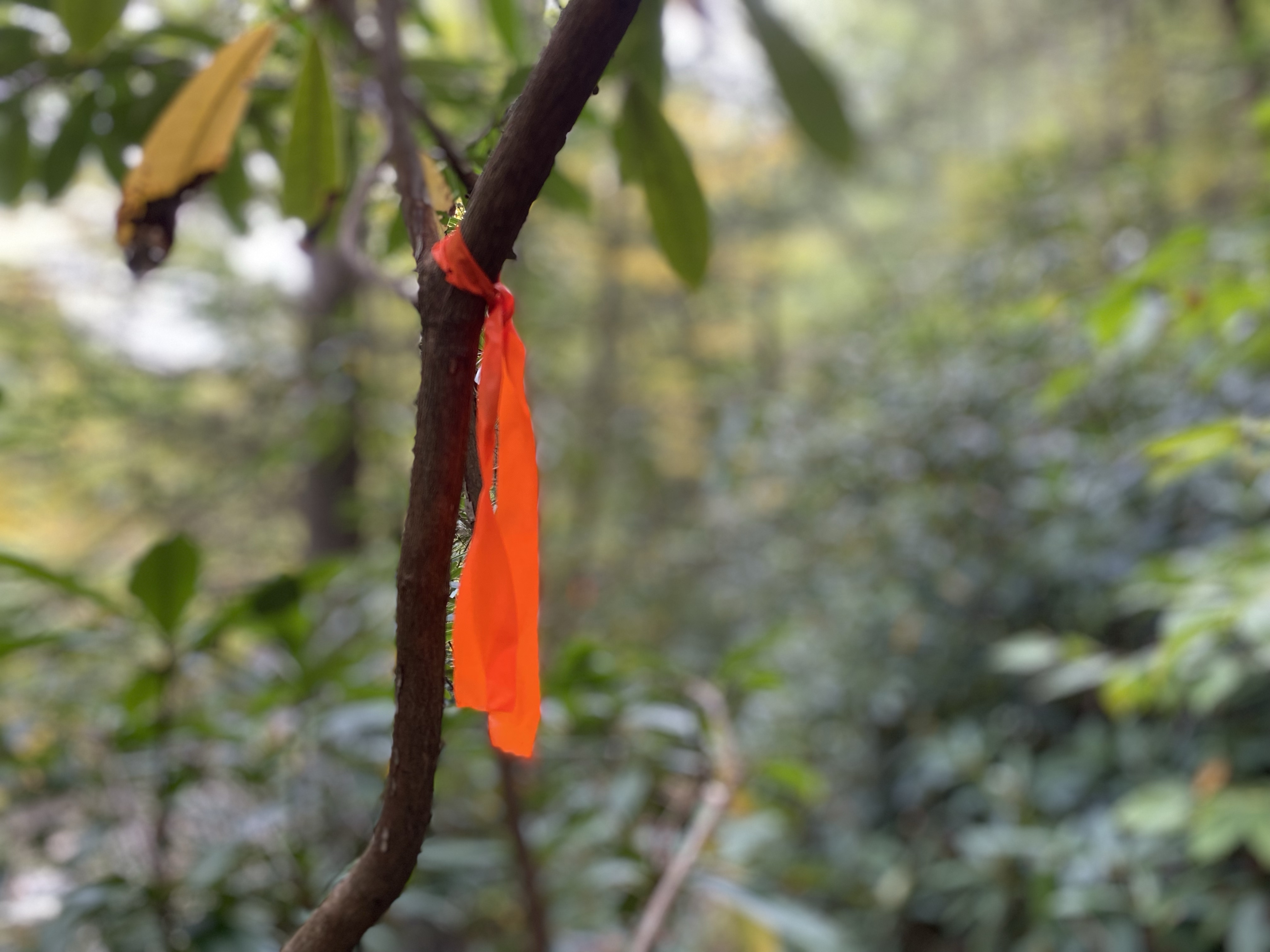
Climbing back up, we continue on to the most difficult to reach waterfall of the day: Kennedy Falls. I’m looking for a small trail-side campsite that marks the location of the descent. I shouldn’t have been worried; the location is obvious as it is, but on my visit it’s also marked by flagging tape. Some accounts I’ve ready say this is a treacherous descent. As I begin working my way down, I can’t help but think of some of the gnarly bushwhacks I’ve done in NC. This route may not be an official “trail” but it’s worn enough to be easy to follow, is marked by flagging tape the entire way, and is even switchbacked in some places. The most treacherous spot is a section where you have to cross a rock on a narrow ledge, and even that isn’t particularly difficult or dangerous. I carefully clamber down to the base and am amazed by yet another incredible waterfall. Kennedy isn’t quite as dramatic as Douglas, but is 100% worth the effort to reach.

After snapping a few photos, I begin the climb back up the hillside to the trail and back to my car. I’m starving and still have to find a campsite for the night, and dusk is rapidly approaching. I decide to head back into Davis, the last place I had cell signal, and do a quick search for restaurants and campsites. I quickly peruse Gaia with an overlanding overlay applied and spot Canaan Loop Rd, a 4×4 road that I’ve previously read about and know to have several dispersed sites along its length. A quick Google search reveals that the Davis end of this road is fairly well maintained and should be easily passable. I decide I’ll find dinner, and then drive down this road until I find a campsite. It’ll be dark by then, but I figure I can manage.
I use Google to search for restaurants near me that are open and find Mama Mia Pie and Pasta. Perfect. I set my GPS and arrive just before dark. There’s no cell signal here, so I’m glad I dropped a pin for Canaan Loop Rd before leaving Davis. I enter the restaurant and request a seat at the bar, where I end up next to a couple and strike up a chat while we wait for our pizzas. The pizza is delicious and I’m reminded why I often enjoy traveling and dining solo: it’s unlikely I would have met these people if I’d been with another person. I eventually pay my tab and leave the warm dining room of the restaurant to brave the chilly autumn night.

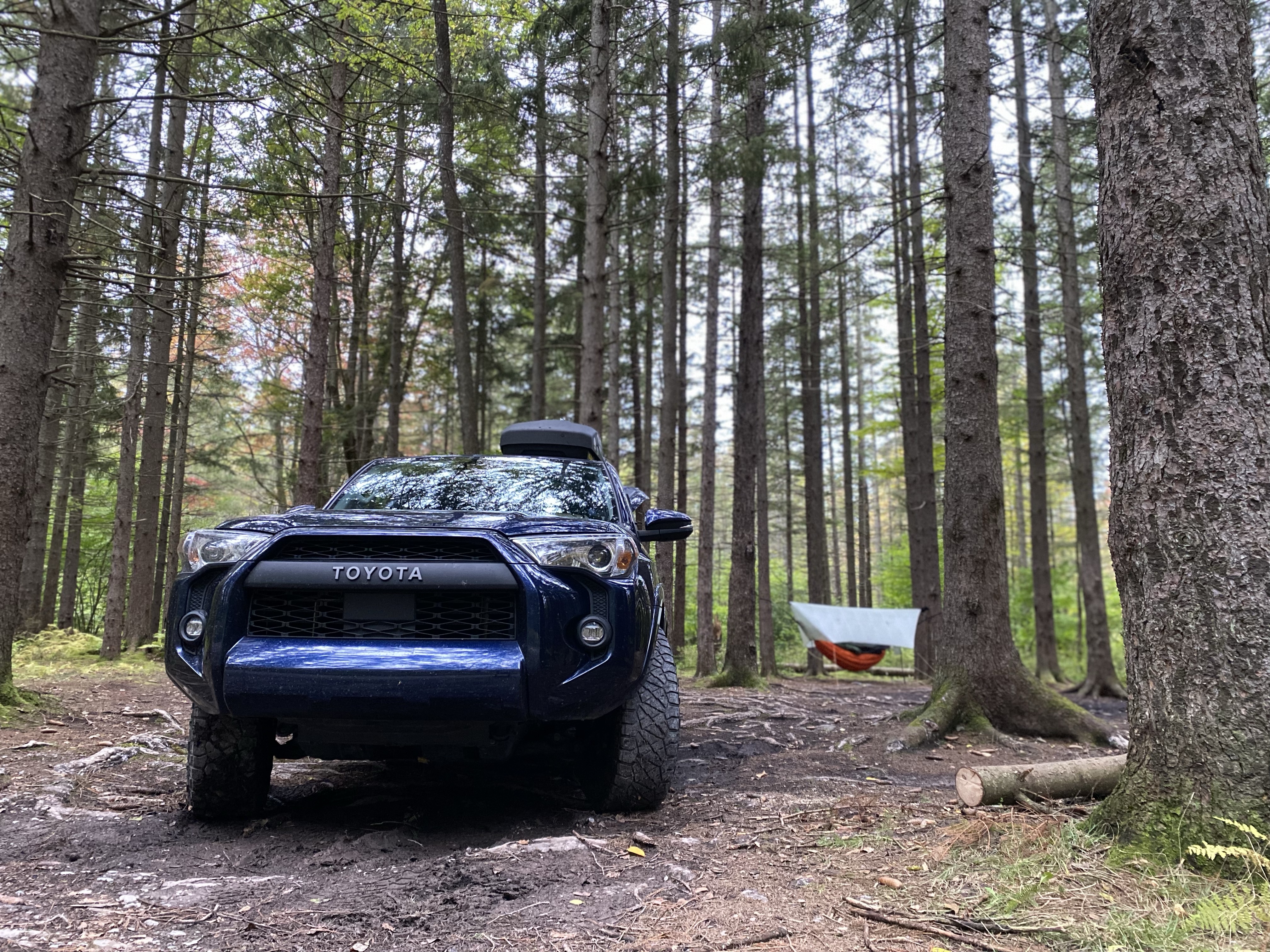
I drive back up to Canaan Loop Rd, about 10 minutes from the restaurant, and begin looking for a campsite as soon as my tires touch dirt. After a couple of miles I find a stand of white pine with a large clear area below, perfect for setting up my hammock. I don my headlamp and leave the car running while I set up camp, to keep it warm. The air is quickly becoming frigid and I hurriedly rig my hammock and do camp chores. The night is eerily quiet, all the critters must be, understandably, burrowed somewhere warm. Once camp is set up and my chores are finished– cathole dug, Shooter fed, hammock ready for sleeping– I climb back into my heated driver’s seat to read for a bit before bed. I eventually leave the warmth of the car and climb into my hammock for the night.
October 4, 2022
Chimney Top via North Fork Mountain Trail
I awake early to sun beaming down through the conifers above. It’s warmer this morning than I expected it to be, and I quickly break camp and head to my next destination. Jen and I had contemplated hiking the North Fork Mountain Trail this past weekend and ended up nixing those plans due to bad weather. The forecast today, however, looks super for this higher-altitude hike. I pack up and get on the road to Seneca Rocks.
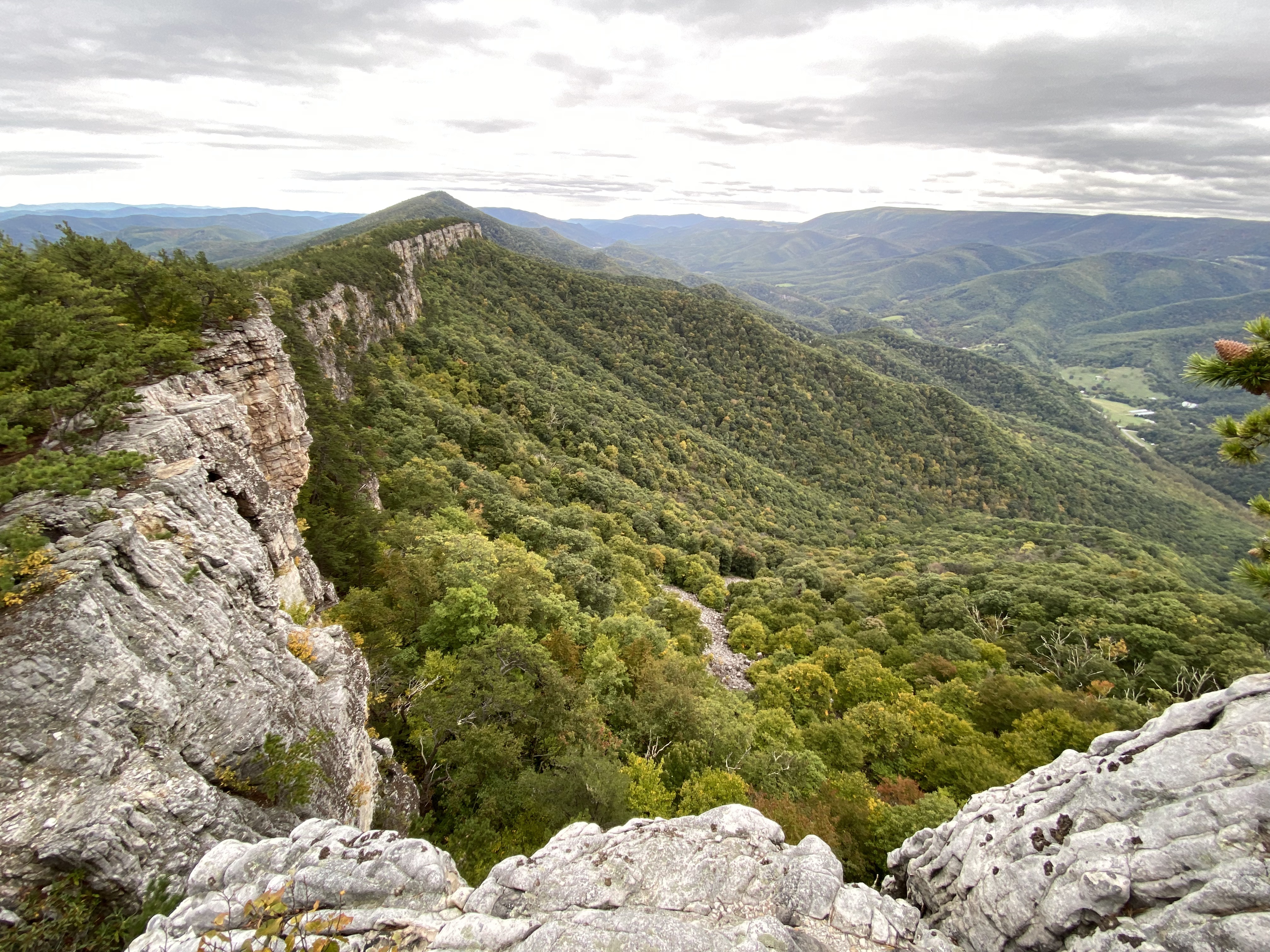
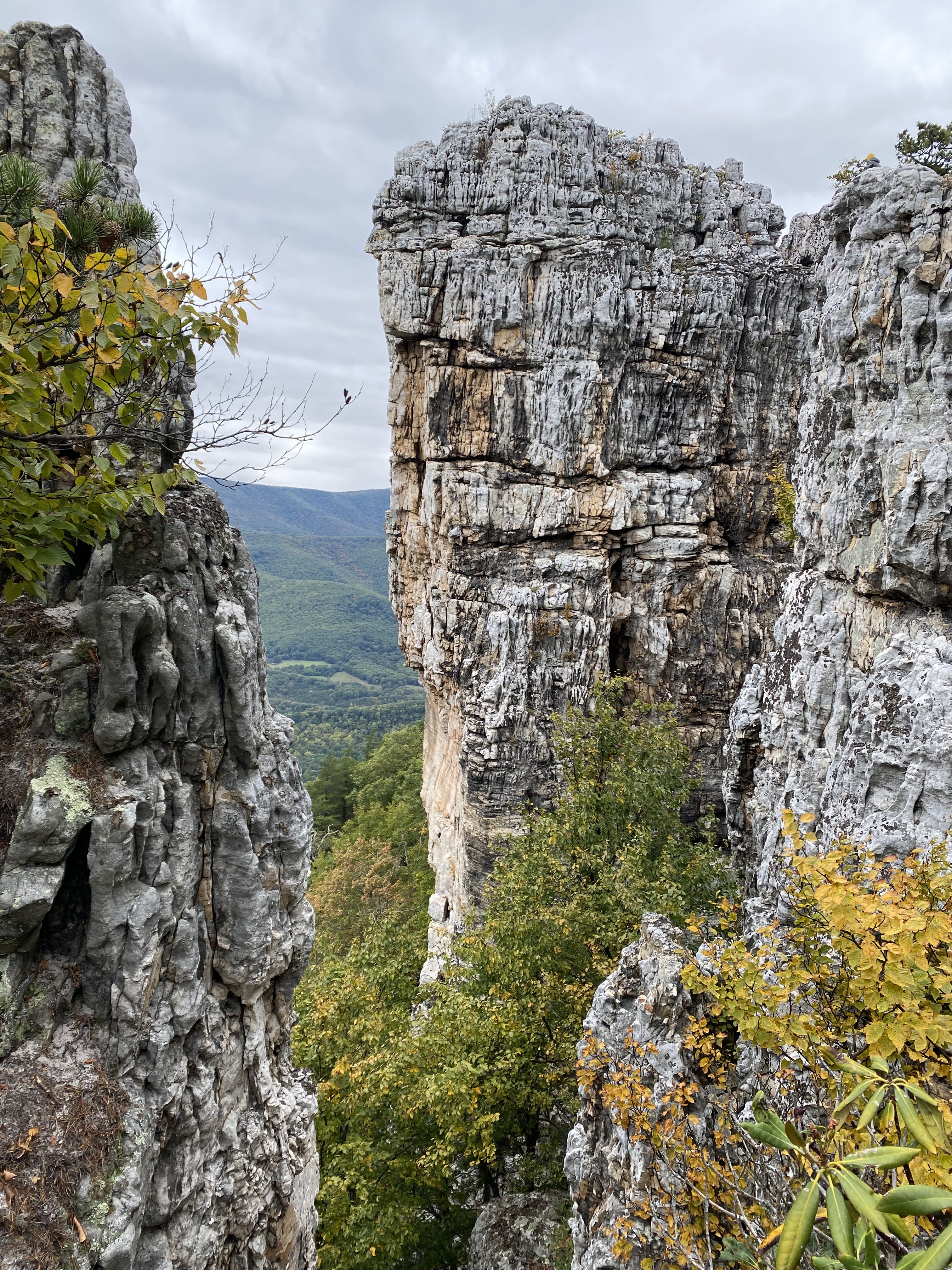
The North Fork Mountain Trail is 24+ miles long from end to end, but today I only plan to do a small portion of it. I’ll start at the North Trailhead and hike up to Chimney Top, a total distance of 5.7 miles round trip. Several weeks ago, when I was up at Dolly Sods, I saw the rock outcroppings along the ridge where the NFMT runs and am excited to see them up close today. The trail starts steep and stays steep, an unrelenting ascent as it climbs toward the ridge. I huff and puff most of the way, but the weather is perfect and it feels good to really push myself a bit. Overall, this hike ends up having over 1900ft of ascent from bottom to top, more than some 14’ers I’ve climbed! Once you reach the ridge, the grade becomes a little more reasonable and there are several opportunities to step out of the treeline onto rock outcroppings with views of the surrounding mountains and valleys.
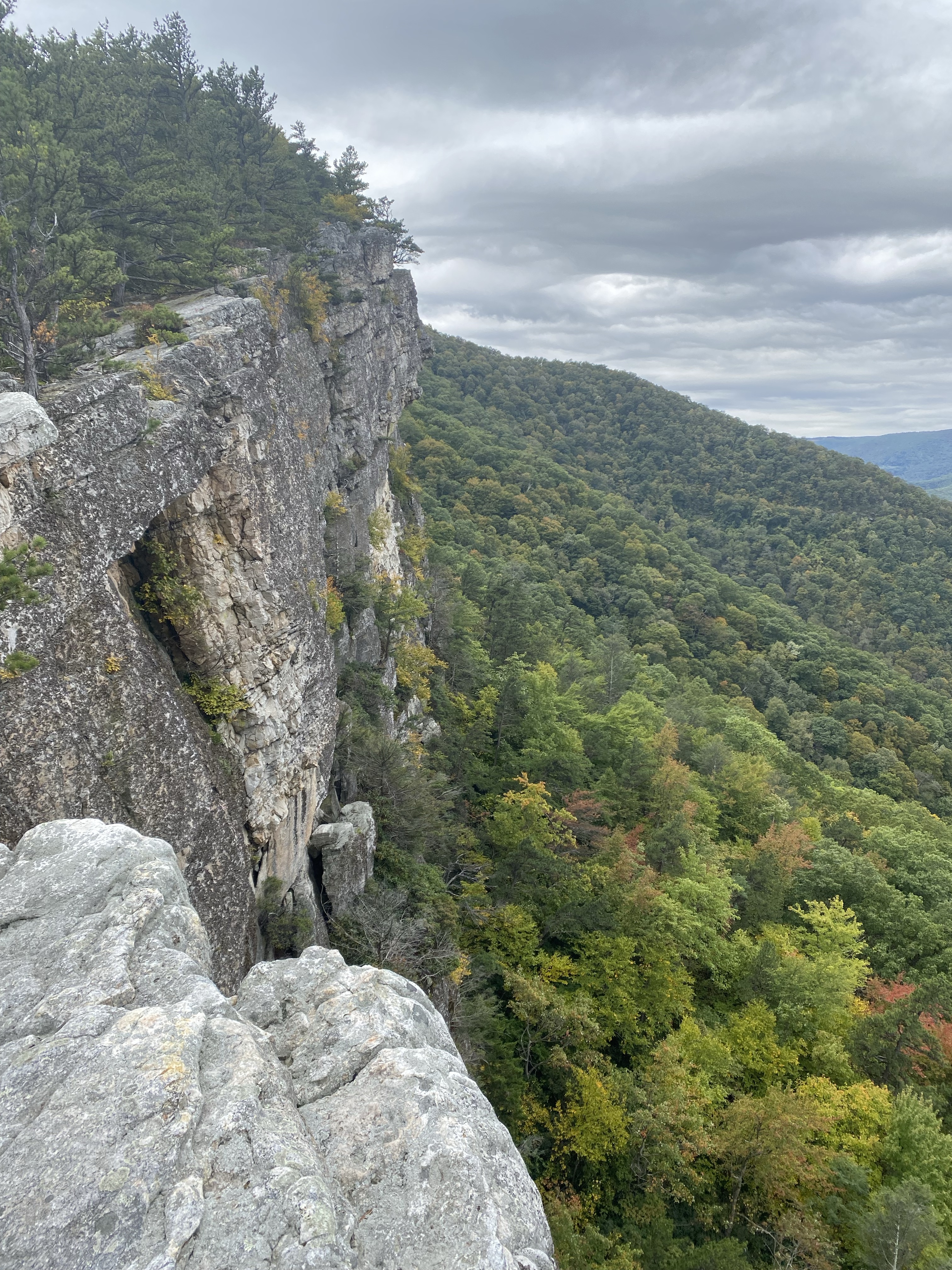

I arrive at Chimney Top as the sky begins to cloud over, making for dramatic lighting on the landscapes and rock formations at the top. I also arrive to the annoying and unmistakable buzzing of a drone. “Great,” I whisper to Shooter, who has his ears pricked in the direction of the nerve-grating sound. I’m hungry, which is probably making me more cranky than I should be, so I decide I’ll snack while waiting for the drone operator to finish. Only then do I notice a young woman off on another rock outcrop, playing on her phone and appearing rather bored. I wait around and the drone buzzes and the woman shifts her weight from one hip to the other. I wait some more and a male voice from somewhere above me on the rocks yells, “Ok, I’m ready!” The woman sheds her coat down to a tank crop top and climbs up on a rock. It’s really cold up here– I’m in a fleece and a long sleeve. She stands on top of the rock for no less than another 20 minutes while the drone operator flies the drone in circles around her. I’m finished with my snack and beginning to wonder if they will ever finish when I feel the first raindrops on my face.
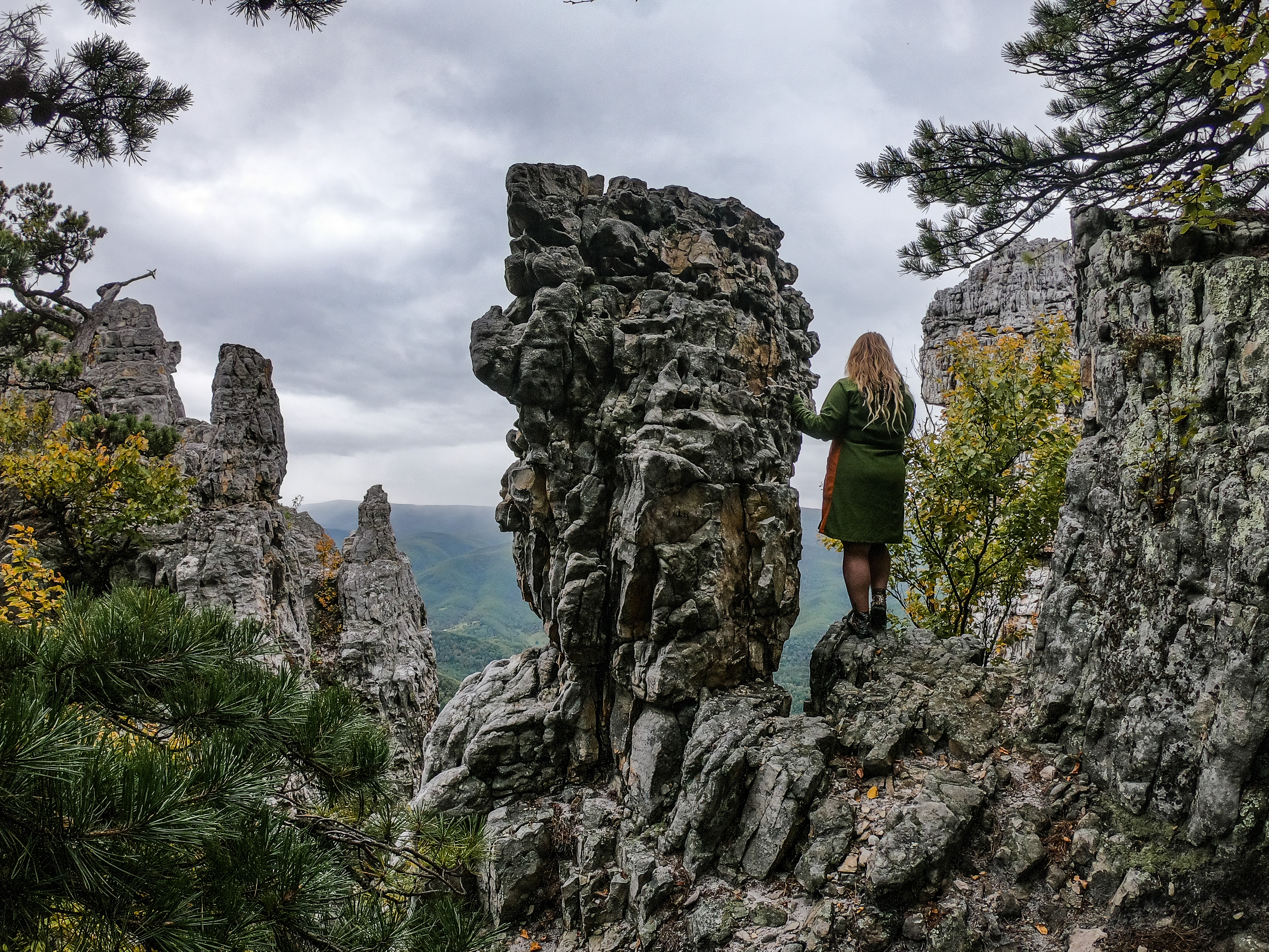
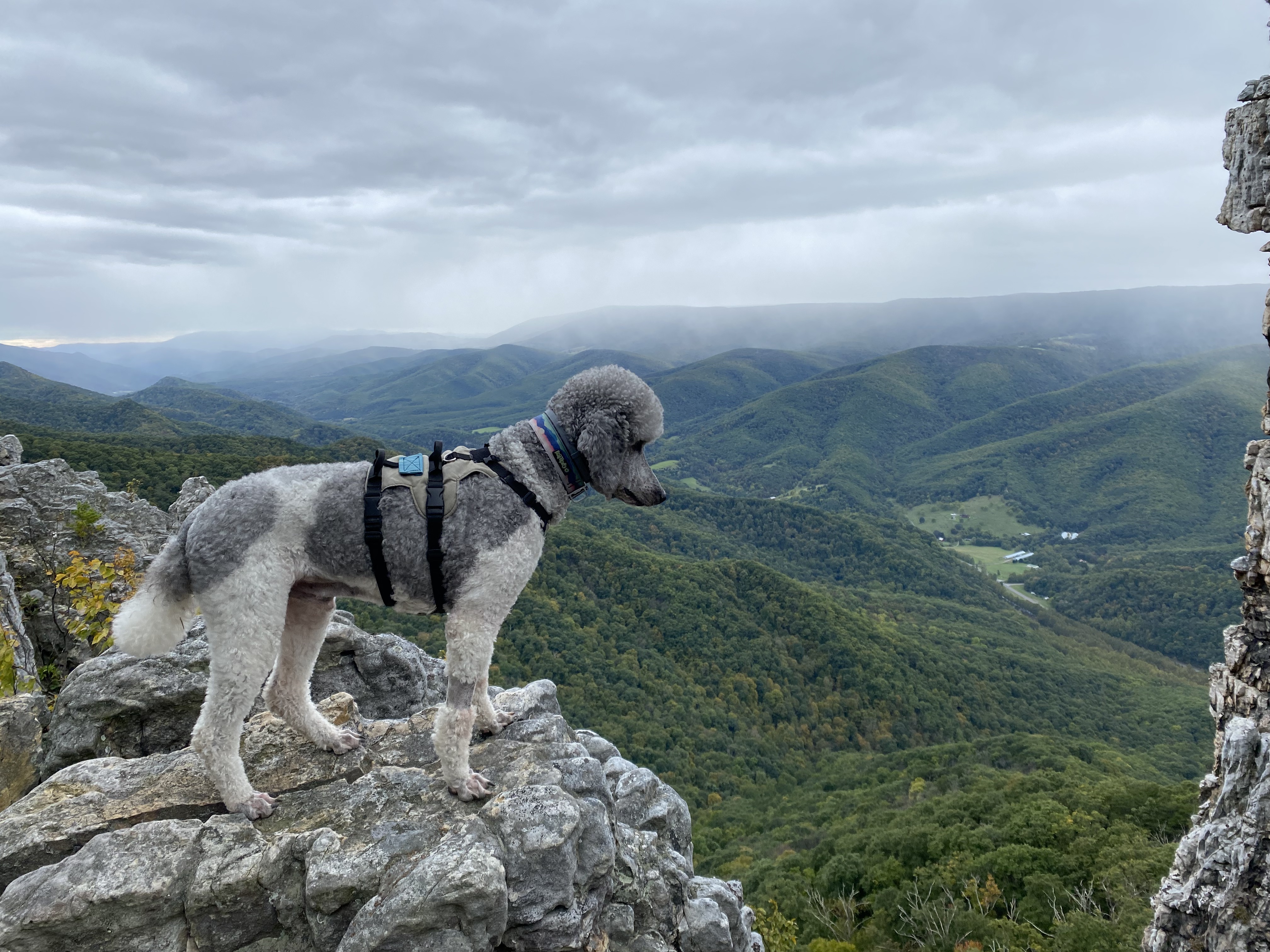
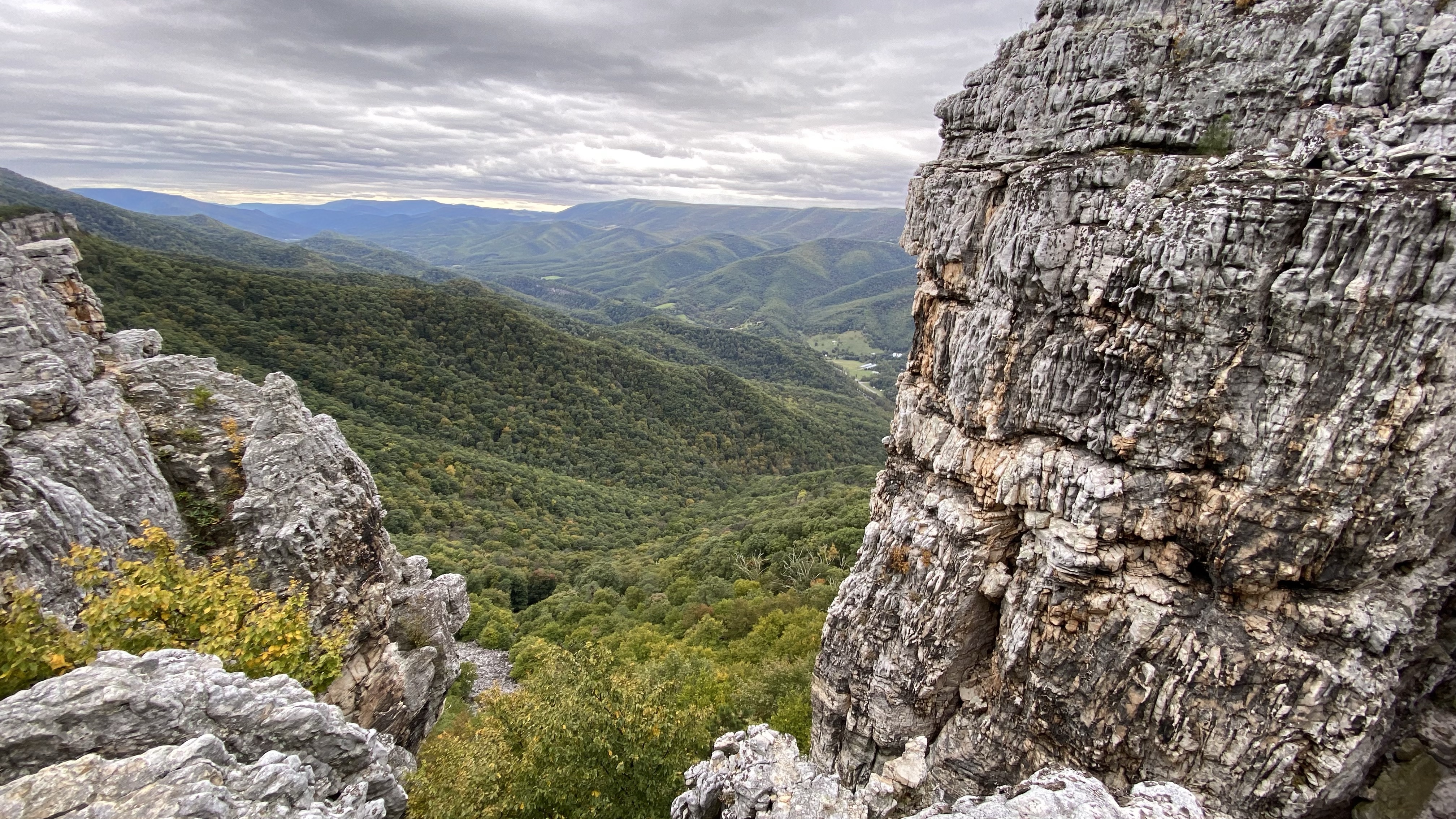
I guess the rain finally scared them off and I got a few minutes to try to take some photos of my own before having to head down and try to beat the storm back to the car. In all, this was an absolutely gorgeous hike. The view from Chimney Top just might be the best view in West Virginia and this hike is in my top 3. I wish I’d gotten a little more uninhibited time at the top but even inconsiderate drone operators couldn’t put a damper on this gorgeous place.
