
May 29, 2023
Just here for the hike stats? Click here.
Last night before falling asleep, I set a relatively early alarm with intentions to hike the Plott Balsam Traverse today. The weather was set to be beautiful, and I went to bed reasonably early for me. My planned hiking partner had to cancel late yesterday evening, but I still wanted to go. When my alarm went off at 8:30, which is a perfectly reasonable hour, my body screamed for more rest. I briefly arose and went to the restroom, but decided to lie back down for what I told myself would be just 30 more minutes. When I woke up again, it was almost noon: way too late to start a difficult hike like the Plott Balsam Traverse.
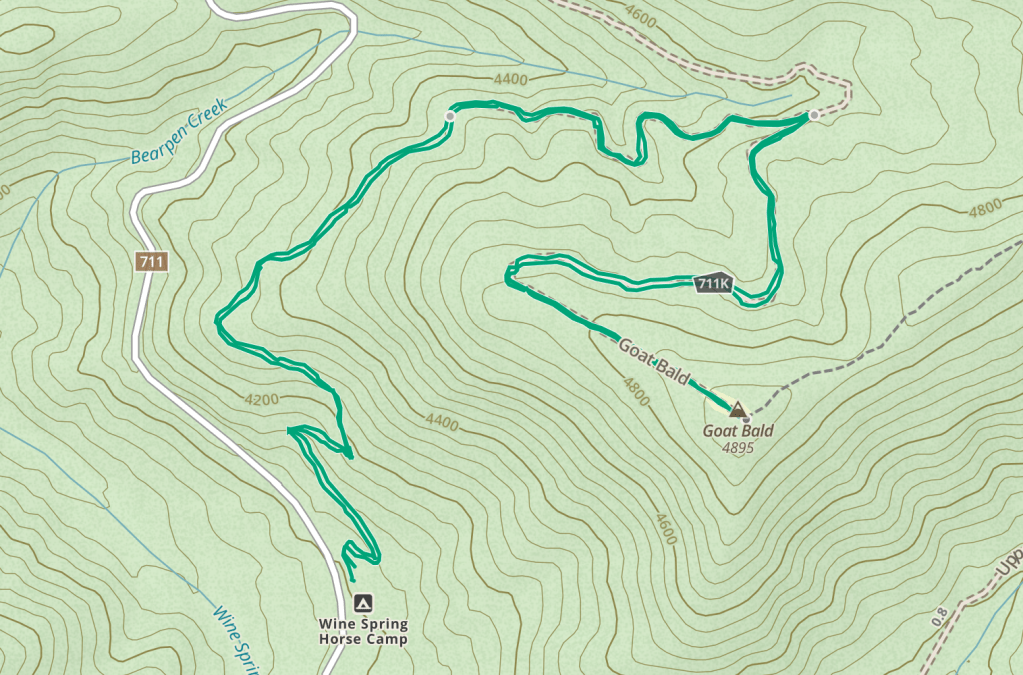
I kind of waffled around a little bit, went back and forth on a couple of options trying to decide what I wanted to do today. Something in me really wanted to be up high with views and to be able to see some mountains. Another part of me wanted to do a waterfall due to recent rain. Ultimately, I settled on driving out to a fairly remote part of Nantahala National Forest to check out some trail systems that I’ve known about for a while but never bothered to visit. One of the reasons for that is these trails are marketed as horse trails, not hiking trails, but all trails are hiking trails. So, I looked up the Wine Springs Bald Loop, which the Forest Service has listed as 7.5 miles. I don’t have time for the entire loop today, but this trail does climb a mountain called Goat Bald, which the Forest Service also states has “spectacular views”.

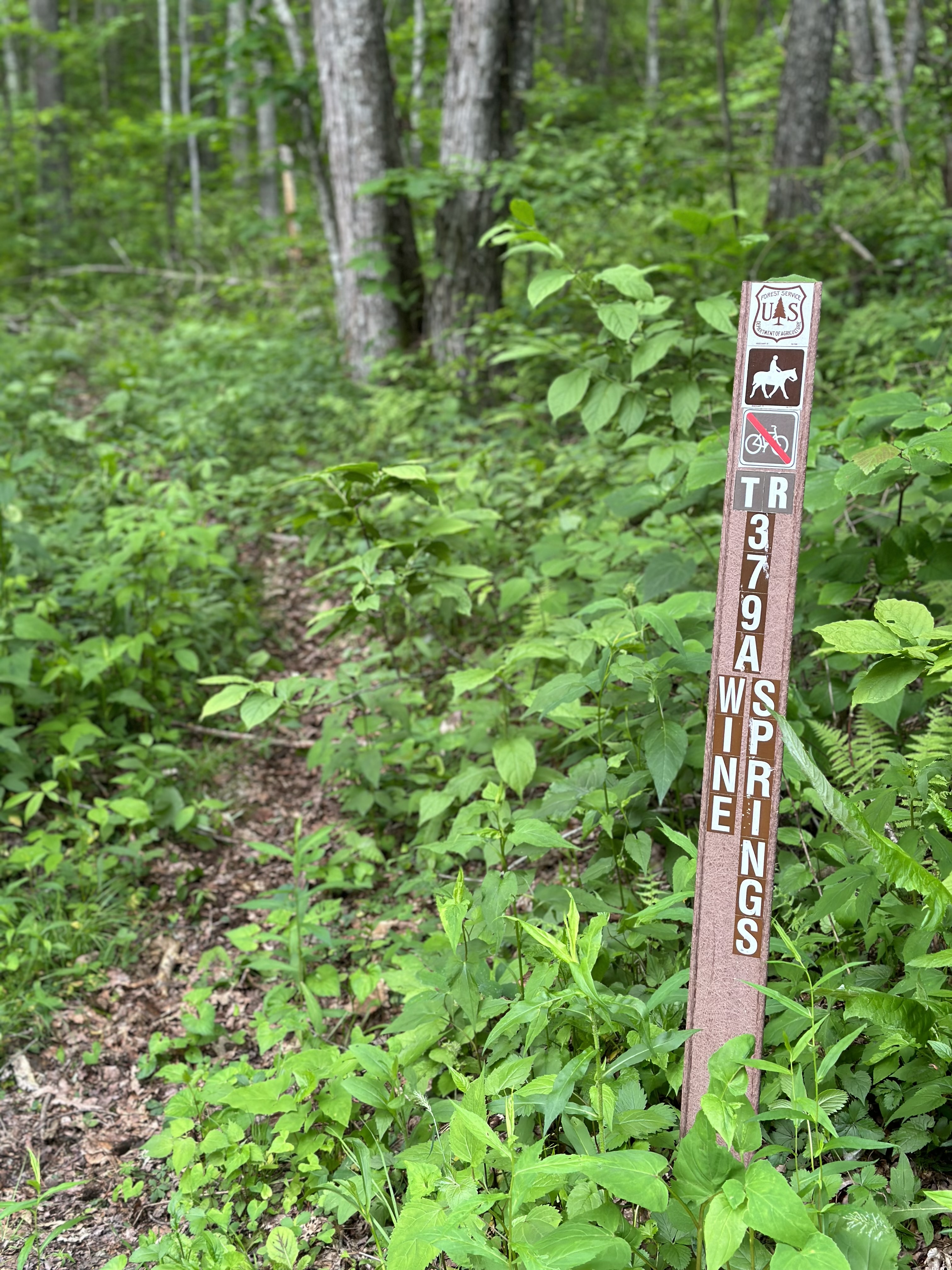
I drive into the mountains and turn right onto FS711. Funny story time: my grandmother’s ex-husband talked about this road a lot whenever they were married. He had family from the Franklin area, and he was always talking about “seben-leben road” in his best southern Georgia accent, but he could never really tell me where it was or why it was important, just that it went up “seben-leben mountain.” Well, I’m not sure Seven Eleven Mountain exists but FS711 sure does, and I’ve driven past it dozens of times on my way to other places. Notably, Dirty John Firing Range and Wine Springs Horse Camp are accessed via this road. The trailhead for Wine Springs Loop begins at a large parking area for Wine Springs Horse Camp. There is a pit toilet here just beyond the gate, but the campground is by reservation only and is empty when I arrive. I park and head out on the trailhead, which is marked by a USFS trail sign. There is immediate evidence of recent use by horseback riders… and that’s about it. The trail is horribly overgrown. Despite that, it’s easy to follow and blazed with orange diamonds. I tromp through the underbrush as I round several switchbacks on my ascent to the summit.
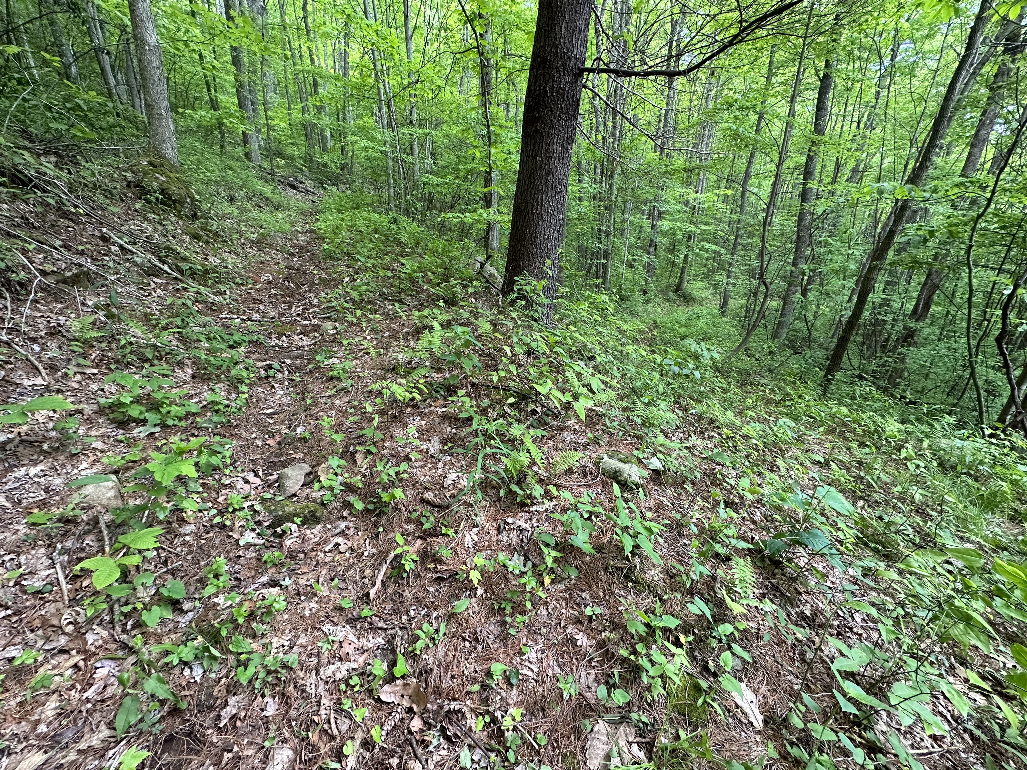
At 1.34 miles, according to Gaia, I reach an intersection. Finally, I’m off the overgrown trail– which I’m pretty sure is just an old, old, old logging grade. Here, it intersects with another old logging road that’s slightly less overgrown and shows some evidence of occasional administrative vehicle use. This is the “trail” I’ll take to the summit. I’m admittedly not enjoying this hike very much, but I’m going to continue up to the summit. When I say overgrown, I mean wading through waist-high growth. I’m used to bushwhacking, but the undergrowth is usually pretty clear because you’re under tree cover. I feel like I’m going to be covered in ticks, even though thankfully, I haven’t seen any ticks yet. I’m hoping that perhaps it’s still a little too cool at night at this altitude, almost 5000 feet, for the ticks to really proliferate yet.
I do think that this could potentially be a pleasant hike, maybe in the fall or winter months when some of the vegetation has died off and isn’t so thick. The sign at the trailhead echoed the USFS website’s claim that there’s a spectacular view from the summit of Goat Bald. I’m skeptical because I feel like if there was a spectacular view up here, I would have heard people talk about this place, and I never have, so we’ll see.

Once I’m on the slightly less overgrown logging road, the trail levels out a bit and the climbing is easier. I can see the “wildlife clearing” mentioned on the USFS website through the trees, but I encounter a downed tree completely blocking the trail before rounding the final switchback. The equine friends who’s hoof prints I’ve been following clearly walked around this through the woods, so I follow their route to get past the tree. I enter the wildlife “clearing” which at this point is almost entirely shrubs and small trees that are taller than my head. Wild roses arc over the trail, creating a menacing path to the summit. I’m dodging thorns and trying to make sure I don’t step on a snake, and I’m certain there’s not going to be a view at the top.

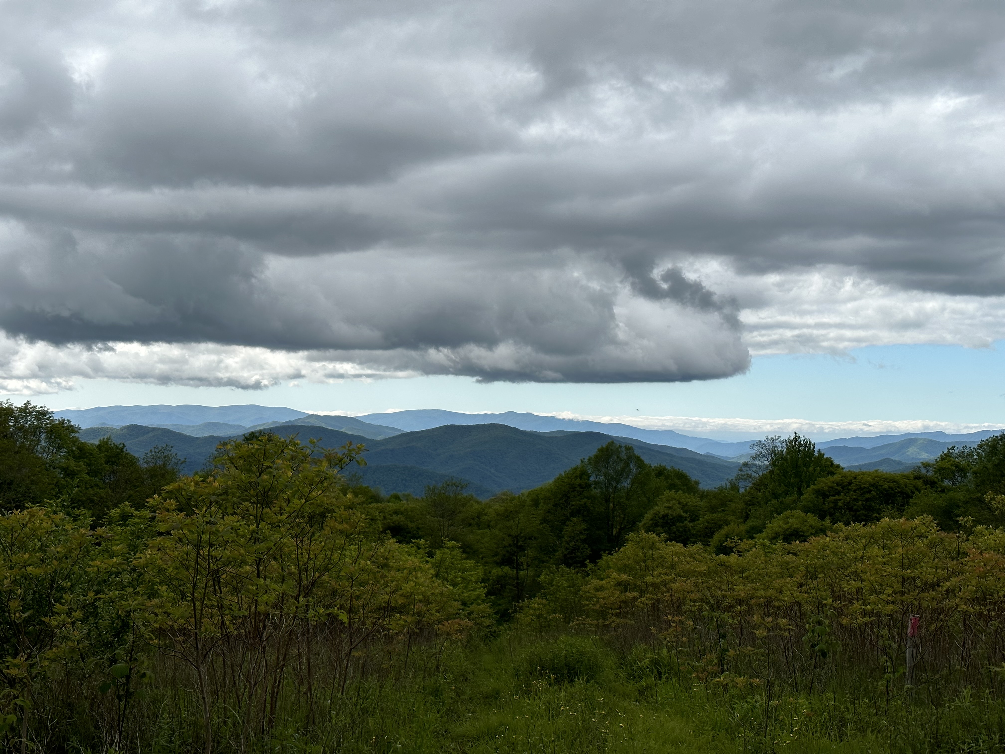
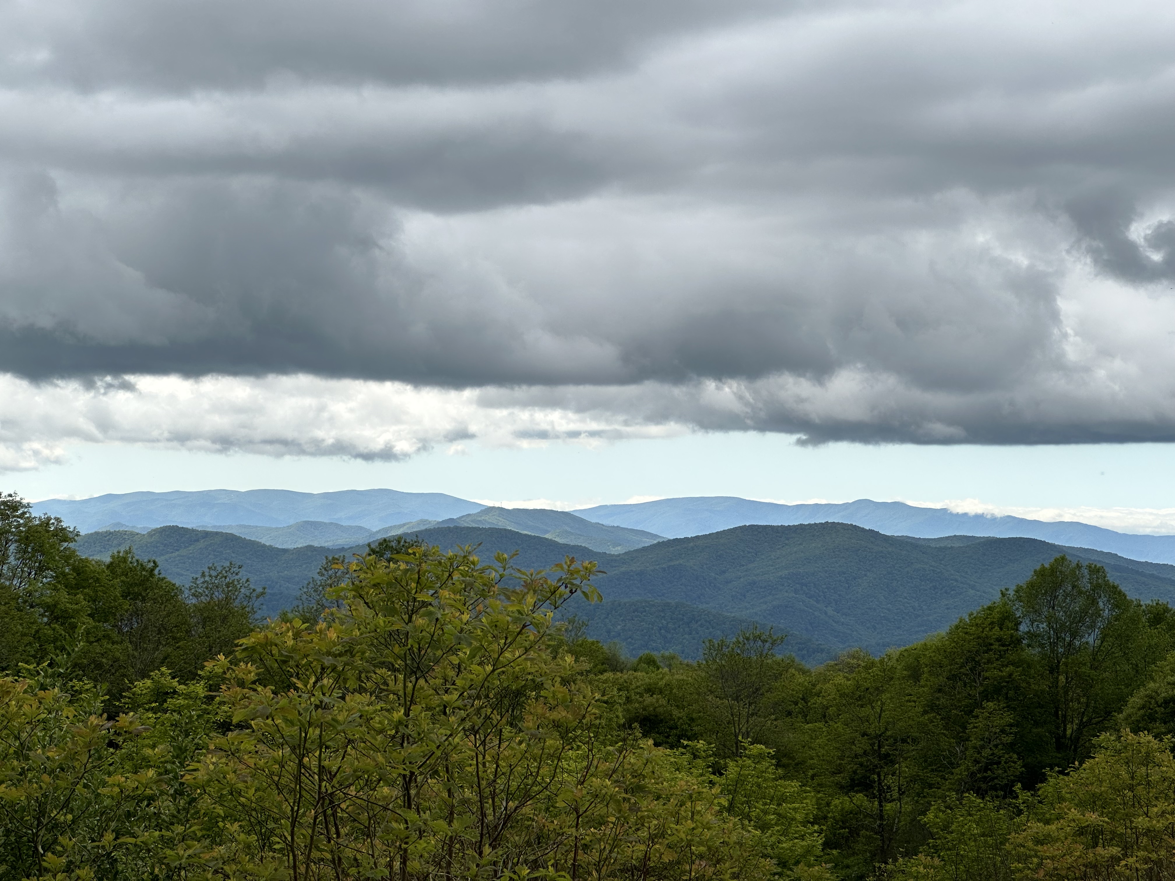
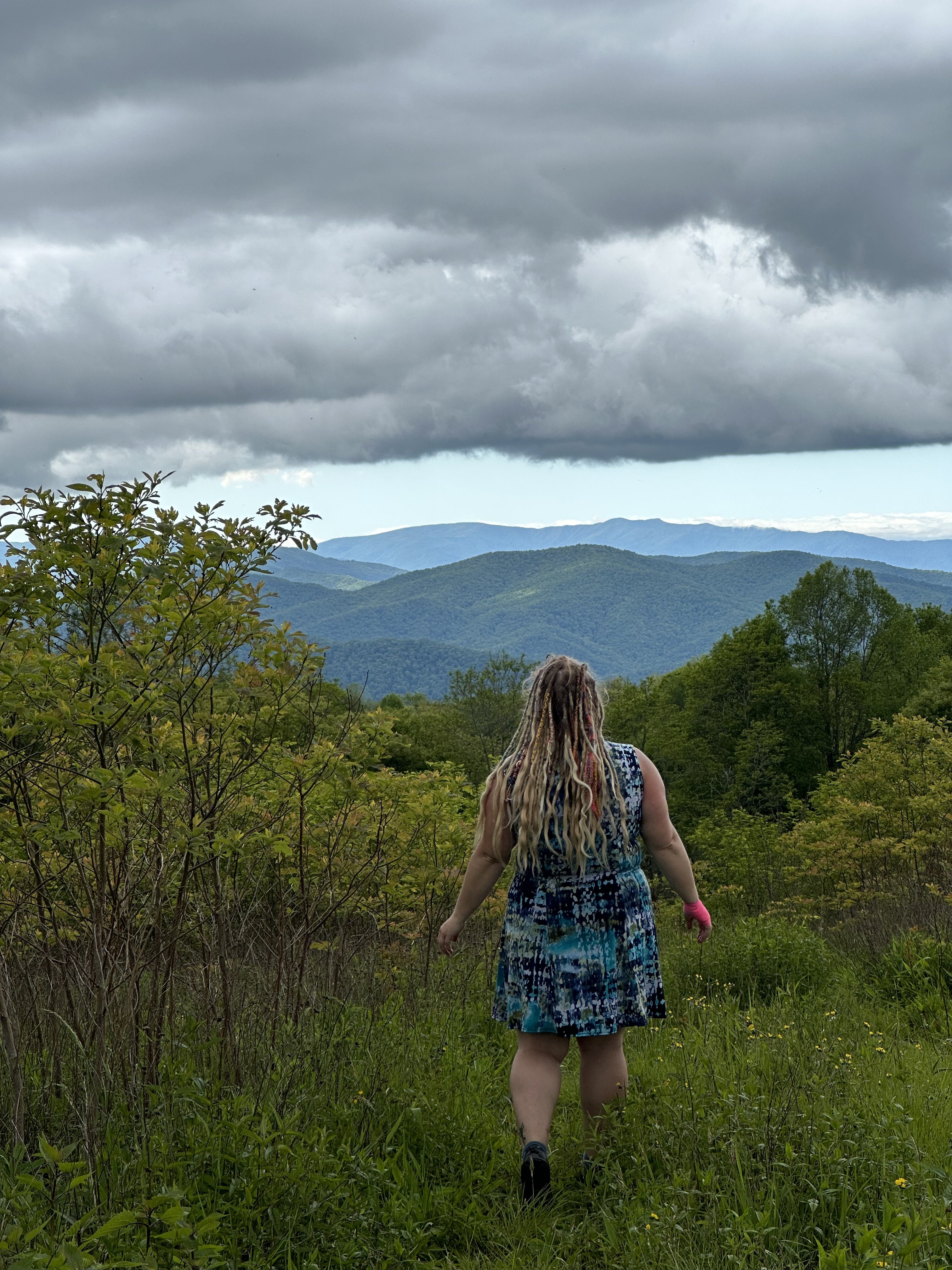
I finally crest over the top of a grassy knoll. This is clearly the summit even though there’s no marker here, because it’s the highest point around. I say to myself, “Yeah, see? I knew this hike was going to be a waste of time. I knew there wasn’t going to be a view up here. I knew it was going to be overgrown.” I’m pretty disappointed, but I have to pee, so I set my pack down at the top, grab my Kula Cloth, and turn to find a spot behind me. Looking back the way that I just came, my mouth falls open. Stretched out before me is a wide, vast view of these beautiful mountains covered in fresh spring leaves with rows clouds rolling in behind them. While I won’t say that it is even remotely the best view in Nantahala National Forest or that it is particularly worth the slog of a hike I just made to get to it, I am at least pleasantly surprised that I got a view at all. It’s quite pretty, and I’m grateful that I did this hike if for no other reason than I’d never explored this part of Nantahala National Forest before. I’d like to come back and hike this entire loop. I can’t believe I’m saying that, but I would consider doing it in the fall or the winter. This would be a great winter hike because there would be a lot more views and a lot less undergrowth to fight through.
Hike stats:
- Length: 4.3 miles
- Moving time: 2h 22m
- Ascent: 773ft
- Difficulty rating: 3/10 — annoying, but not difficult
- Trailhead coordinates: 35.17753, -83.61407
- Blazes: orange diamond

Leave a comment