
Originally published October 28, 2022
There are three routes to Cheoah Bald, and they are all long and difficult. The first time I ever stood upon this mountain was in April, 2015; it was my second day fully “on” the Appalachian Trail as a thru-hiker and I barely stopped at the view for a photo. The night before, I’d slept in a shelter with a dozen other hikers, one of the only nights I slept in a shelter on the trail. I found shelters to be dirty, noisy, and uncomfortable, and I didn’t sleep much that night. I did, however, awaken to the smell of bacon cooking– though my first thought was that I must have been dreaming. One of the other hikers had packed out several packs of bacon, had carried them ALL THE WAY up that awful climb out of Nantahala Outdoor Center, and made breakfast for everyone at the shelter that morning. It was the best bacon I’d ever had, but it was cold, so I packed up and got moving early.
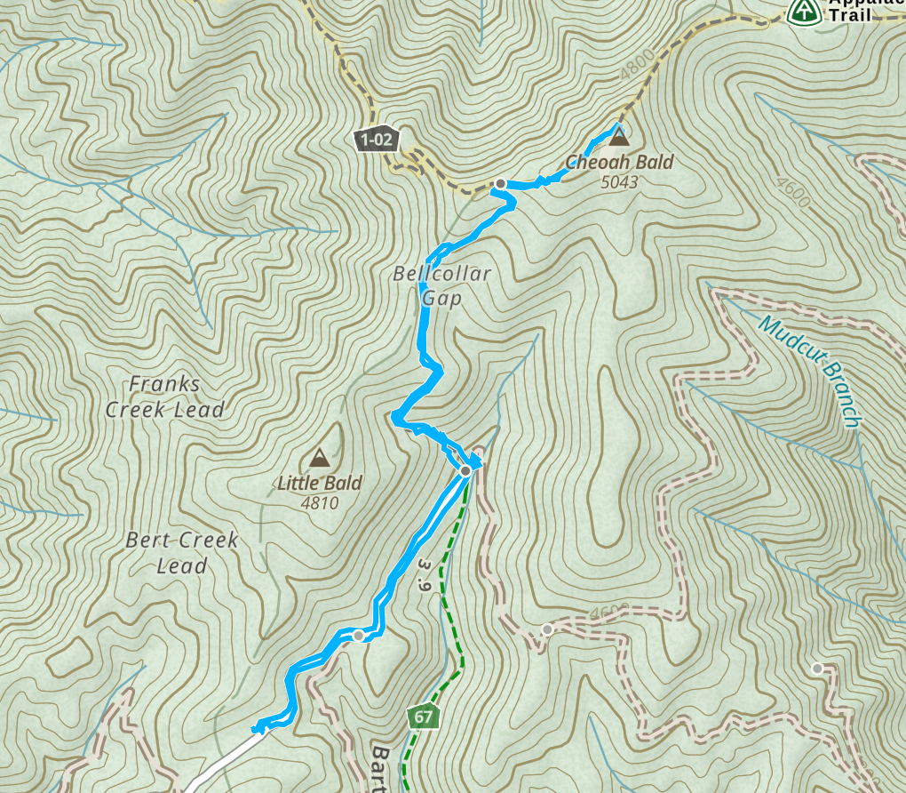
That day, I reached Cheoah Bald in the early hours of the morning, shortly after leaving Sassafras Gap Shelter. I had accessed the summit via the longest route– nearly 13 miles and 3500ft of ascent beginning at Nantahala Outdoor Center and climbing relentlessly to the top of this mountain northbound on the Appalachian Trail. A second route begins at Stecoah Gap and climbs southbound along the Appalachian Trail to the summit; this route is slightly shorter at 11 miles and slightly less steep at around 2700ft of ascent. The shortest route to Cheoah Bald begins where the Bartram Trail crosses US 74 just west of Nantahala Outdoor Center and climbs, absurdly and relentlessly, for 5 miles to an intersection with the Appalachian Trail, and then follows the AT southbound for a short while to arrive at the summit. The length, difficulty, and remote nature of this summit have kept it from becoming a popular destination, but the same factors make it an extremely worthwhile destination, especially in October– when a much shorter route is an option.
Getting to the Trailhead
During the month of October, Nolten Ridge Rd, aka FR 259, is open to the public. Otherwise gated, this road is over six miles of winding, steeply ascending double track– barely wide enough for one vehicle in spots. Since it’s only used for one month out of the year, it is in remarkably good shape and, if you are brave enough for the winding, steeply-sloped nature of it, pretty much any passenger vehicle can make it to the trailhead. A large, grassy pull off has room for several cars to park without blocking the gate, and it’s unlikely to be full even on weekends.
I’ve been exploring western North Carolina for almost a decade, but I didn’t know this road existed until this year. I know I say this all the time, but it amazes me that even after spending almost 10 years regularly getting into the wilderness around Franklin, I still find new places to explore every single week.
The drive up Nolten Ridge Rd is a bit nerve-wracking, but absolutely gorgeous. Today, I drive it in the late afternoon, sunlight gleaming through orange, yellow, and red leaves still hanging on at the end of autumn. I encounter two vehicles along the road, and both appear to be hunters. There are areas where it would be impossible for two vehicles to pass side by side, so it’s important to take it slow and pay close attention, and also to be willing to reverse to a suitable passing spot if needed. I pass with no issues and arrive at the trailhead a long while later to find one other vehicle there. I park and begin the hike.
The Hike
The hike begins where a gate blocks further access down Nolten Ridge Rd. The road continues past the gate on a nearly level walk for about 0.7 miles to an intersection with the Bartram Trail. I reach the intersection to find an SUV with a trailer parked down here, with a logo that reads “Southeast Conservation Corp.” I snap a photo of the logo and make a mental note to do some research on this organization when I get home.
Field note: There is a small stream just beyond where the Bartram Trail crosses FR 259; this is the only easily accessible water source on this hike.

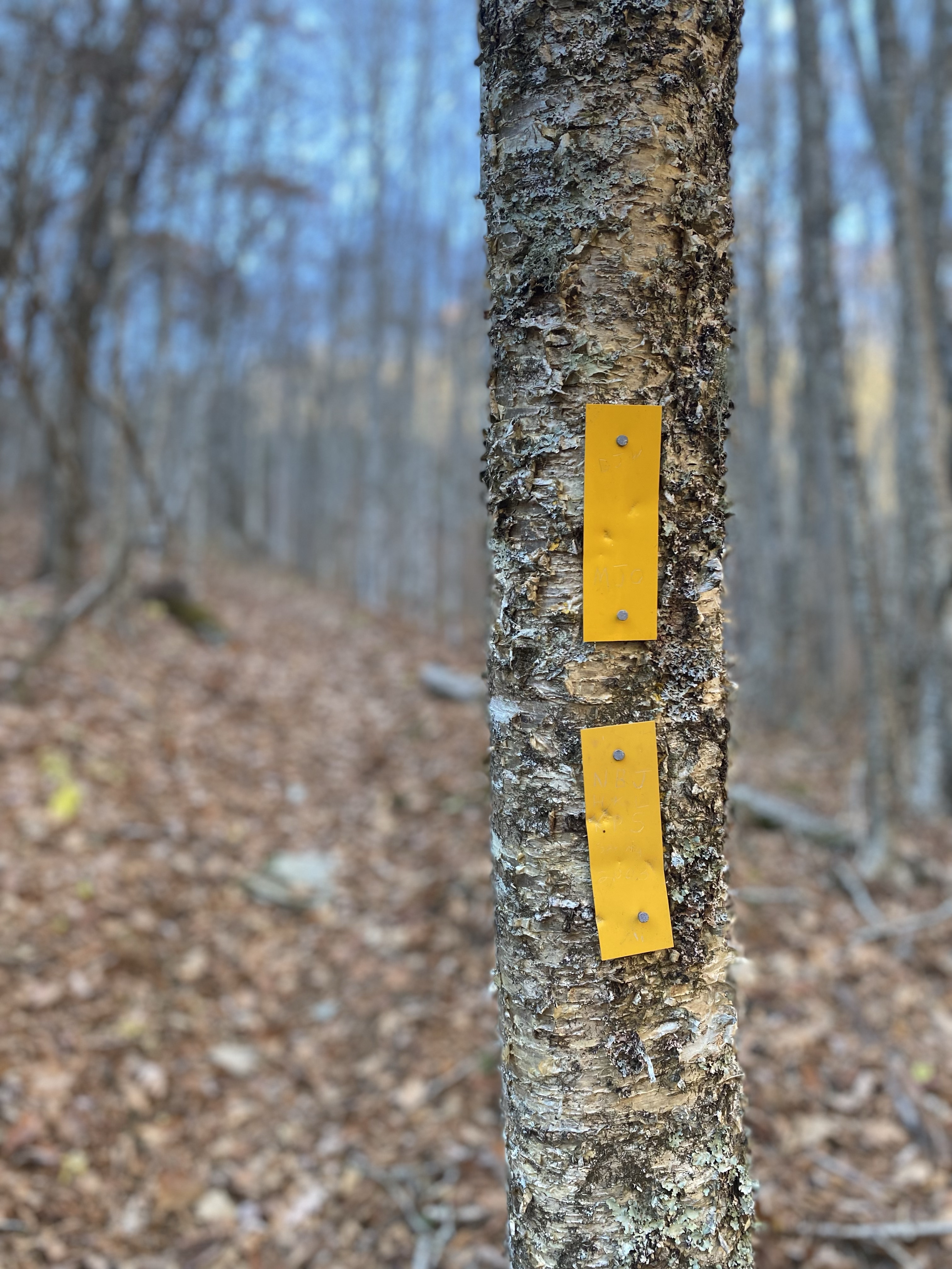
If the road was fairly level, the Bartram Trail section of this hike makes up for it in every way. The Bartram Trail is notorious for being steep, and this section is consistent with that trend. Leaving the road, I climb uphill on an absurdly steep incline, so steep I can’t fully put my heels down in places. I pass a man and woman headed downhill whom I assume are the owners of the Jeep I saw at the trailhead; they remark on Shooter’s good looks and apologize for holding me up. “I needed to catch my breath anyway,” I respond, still breathing heavily. For a while I listen to the birds chirping, then I need something to take my mind off my current misery so I turn on an audiobook. The hike gets slightly less steep for a short time, then becomes steeper again as I climb toward the intersection with the Appalachain Trail.
What I'm listening to: American Gods by Neil Gaiman
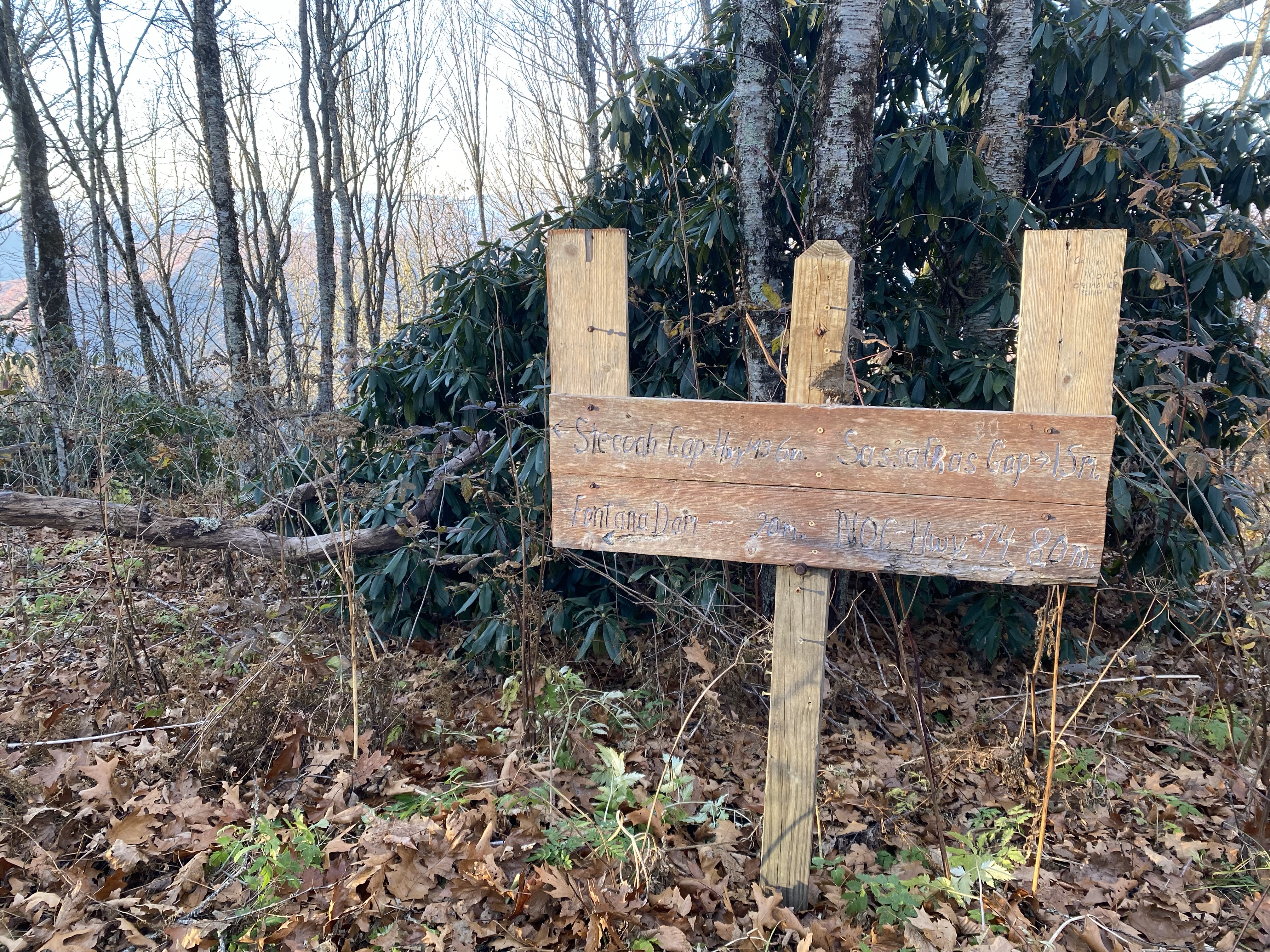
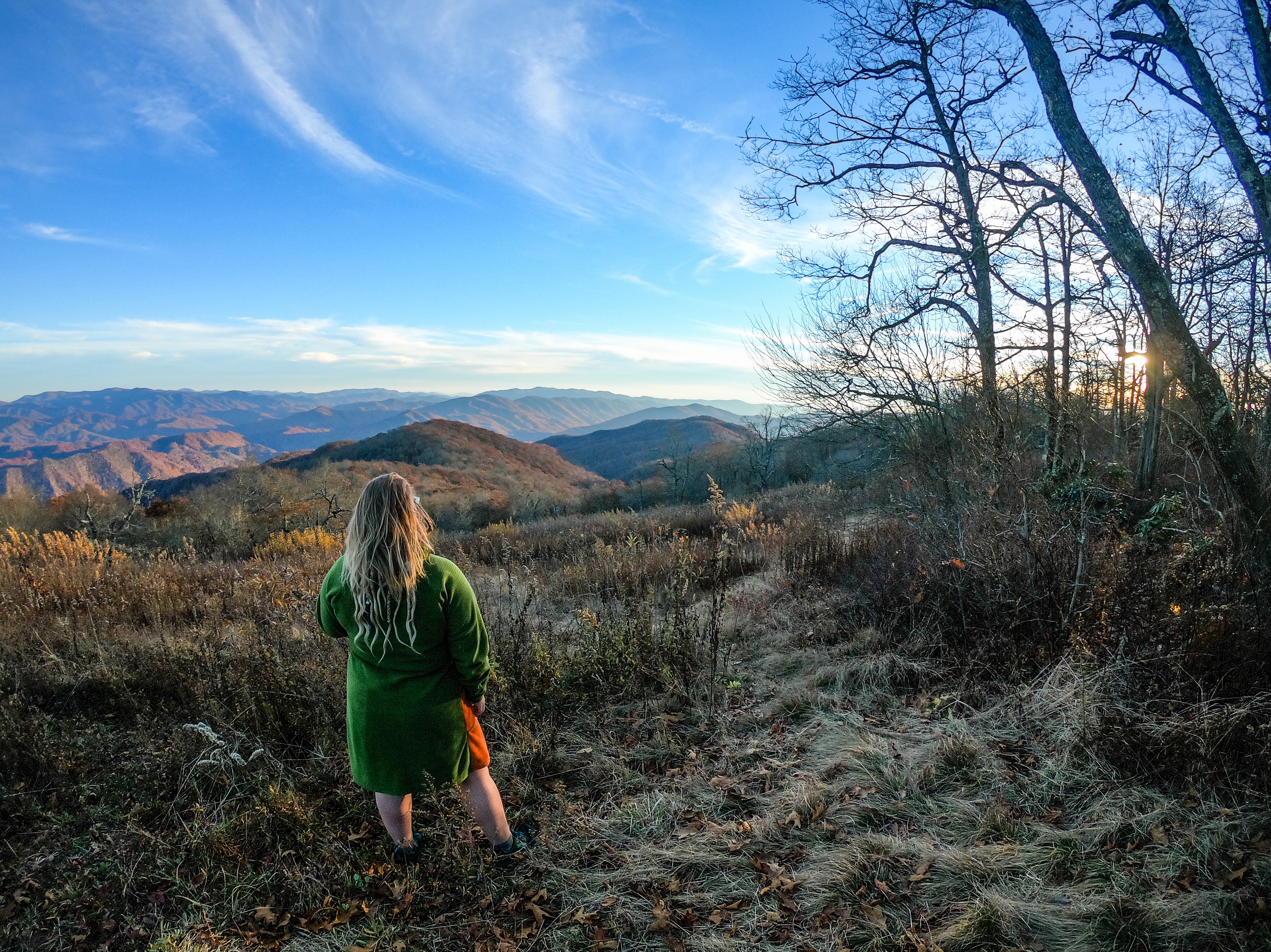
Eventually I reach the Appalachian Trail, an intersection marked by a weathered sign and made most evident by the blazes on the trees changing from Bartram Trail Yellow to Appalachian Trail White. I turn right, heading southbound on the AT toward the summit of Cheoah Bald. One last steep climb brings me to the top, and the expansive views of the “Grandstand of the Atlantic”– aka Cheoah Bald. Cheoah Bald is the highest mountain in the Cheoah Range, and provides views to the south through North Carolina and into Georgia. The summit is marked by a well-worn geodetic marker and an old wooden sign nailed to a tree, though it’s obvious without these markers. I spend some time enjoying the view as the sun dips toward the horizon and bathes everything in golden-hour glow.


Shooter and I begin the descent back to the car once the sun dips over the horizon. I realize on the way back that I didn’t just imagine the steepness. I’m having to carefully descend to manage the grade and hidden rocks and roots under freshly fallen leaves. As the light fades I flip on my headlamp and enjoy the change that occurs as the forest becomes darks. The woods feel different at night: softer, quieter. I’ve always enjoyed night hiking and the serenity it brings, and I thoroughly enjoy my time in the dark on this remote mountain while I reminisce on the last time I was here.

Stats
- TH: 35.31194, -83.69067
- Access: Road only open during month of October, medium clearance recommended
- Length: 3.12 miles
- Ascent: 743ft
- Total time: 2hr22m
- Moving time: 1h43m
- Drive time from downtown Franklin: 1h30m

This post was updated on September 17, 2025

Thanks for posting this on Instagram. Did the hike today and continued on the AT to Sassafras Gap Shelter and return. I never knew about this shorter access option.
LikeLike