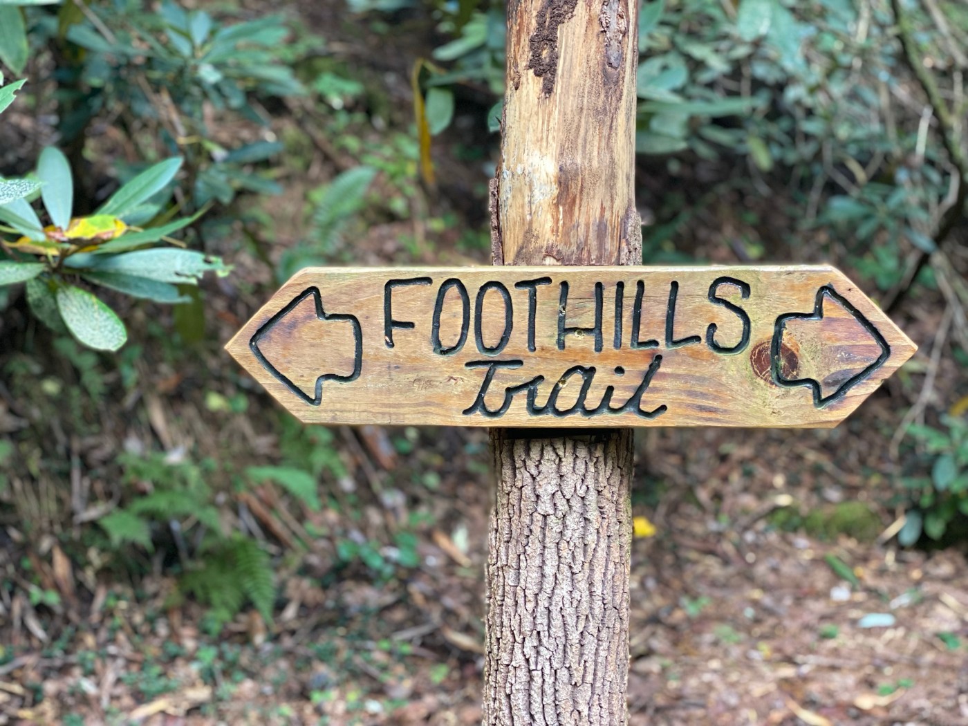
Between September 12-15, 2022, two other women and I embarked on completing the first 31.4 miles of the Foothills Trail, a long distance footpath which meanders in and out of South Carolina and North Carolina and covers a total of 76.2 miles. The first four pages of this blog are an account of the four individual days I spent on trail. If you’re uninterested in the day-to-day dealings and are just here for info on the trail, you can use the table of contents below to jump straight to Page 5: Tracks and Stats. This page contains statistical information about the hike and trail conditions, as well as links to my Gaia GPS tracks for each day.
Day 1: 6.52 miles
Today I’m headed out to hike the Foothills Trail. I’m meeting up with a new friend Jess, someone who I’ve followed on Instagram for a while but haven’t ever met in person. We will be spending four days on the Foothills Trail, three nights camping. Our original plan was to complete a through-hike of the Foothills Trail this week, but we both thought the timeline was a bit of a crunch with our current fitness levels. We decided to just do the first 30-ish miles.
I wanted to to get an earlier start today, but I’m waiting on a package from Lightheart Gear to arrive with my new hiking dresses in it. I was hoping to bring one of these dresses on the trip, but it doesn’t arrive in time and I decide to make do with the dress I already have so we can get going. I’ve also decided to leave Shooter at home on this trip. Walking away from him knowing that he’s staying home while I’m going on a hiking trip hurts my heart, but he’s in good hands with Eleni back at home; he’d enjoy this hike but his aging bones would pay the price. Jess and I leave Franklin and head out to set our shuttle.

Since this is a one-way shuttle hike, we need to leave a car at each end– and we start by driving to where our hike will end. The plan is to end our hike at the Whitewater gravel lot at mile 28.3 on the Foothills Trail, so this is where we will leave a car. However, on arriving we notice what appears to be a pile of shattered automotive window glass, and the lot is right next to a very busy tourist road. We decide to drive down to the main Whitewater Falls parking lot and maybe park there, but signs indicate this is a day use area only. There aren’t explicitly “No Overnight Parking” signs, and FarOut has a user comment that overnight parking is allowed. After some deliberation, we decide not to risk it. I get enough cell signal to check the Foothills Trail Hiking Facebook group and learn that it’s safer to leave a car at Bad Creek Access. That will add about 3 miles to our last hiking day, a compromise that seems worth it for peace of mind.
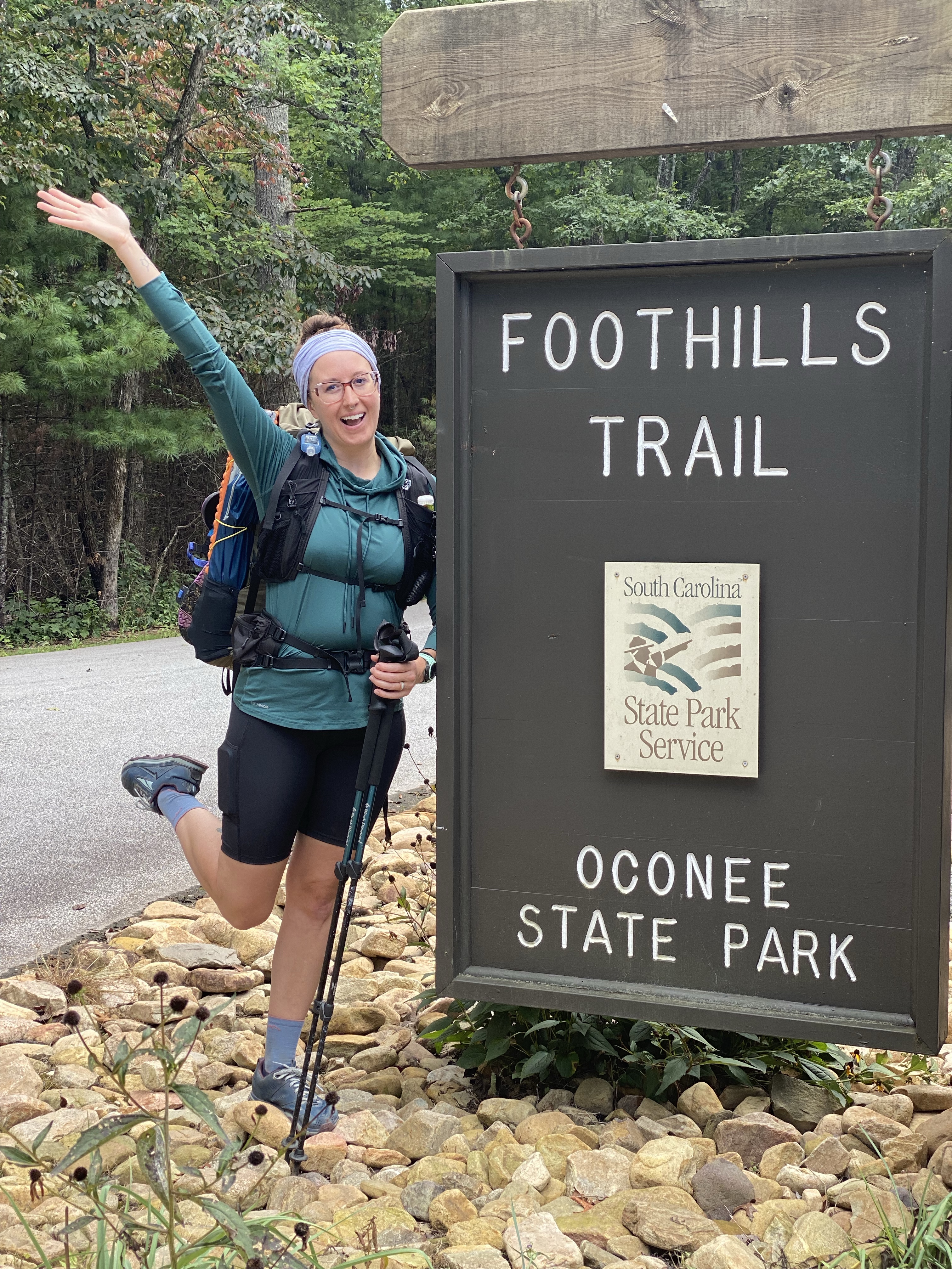
After dropping our end-point vehicle at Bad Creek, we drive to Oconee State Park, the southern/western terminus of the Foothills trail. We leave our itinerary and emergency contact info with park personnel, per protocol, and are able to pay with a debit card. We finally get on trail a little after 4pm.
Field note: Overnight hikers leaving a vehicle at Oconee State Park should NOT pay at the self-pay kiosk at the park entrance. Instead, check in at the visitors center for overnight parking and they will issue you a hang tag and take down your itinerary.
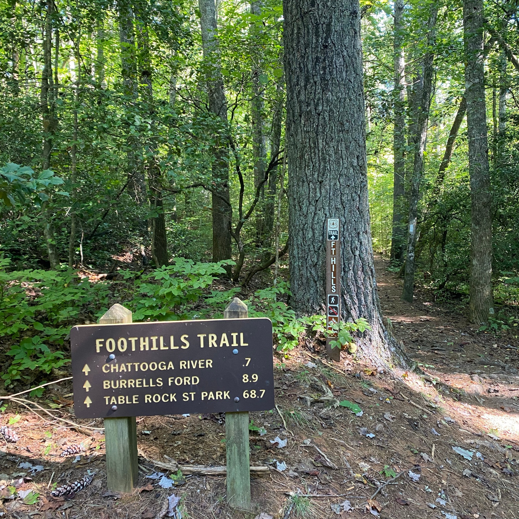
The first few miles are relatively level and the trail is well maintained. This is the first time Jess and I have hiked together, so we chatter endlessly as we walk, getting to know each other. The miles pass quickly. At 1.3 miles we pass the spur to Hidden (Disappearing) Falls, which we decide to bypass due to the late hour. This waterfall is a long way off trail, and we are running out of daylight. At about 2 miles, we apparently pass a trail that possibly goes to a firetower (or, possibly a firetower site) that I didn’t know existed at the time. I definitely have to come back for this waterfall and firetower on a future hike.
We picked three possible end-points today: Tamassee Campsite at 3.5 miles, an unnamed campsite at 6.5 miles, and Licklog Branch at 8.5 miles. We left this choice open-ended depending on our start time and how we were feeling. We arrive at Tamassee and decide that we have enough daylight and energy left to reach the next camp, three miles further on. There is a 700ft climb between here and there, but it’s not terribly steep and we make good time the rest of the way. In all, we hike 6.5 miles in just over 3 hours and I’m quite pleased with myself for making a better than 2mph pace carrying a full pack.
We reach camp just before dusk and get busy building our respective shelters. Dinner follows, and we share a small box of moscato I packed out to celebrate our adventure and budding friendship. Camp chores of filtering water and throwing bear hang and pre-digging cat holes take up most of the next hour, and then we both retreat to our homes for the night to drift off to the lullaby of frogs chirping and the nearby creek gurgling.

Leave a comment